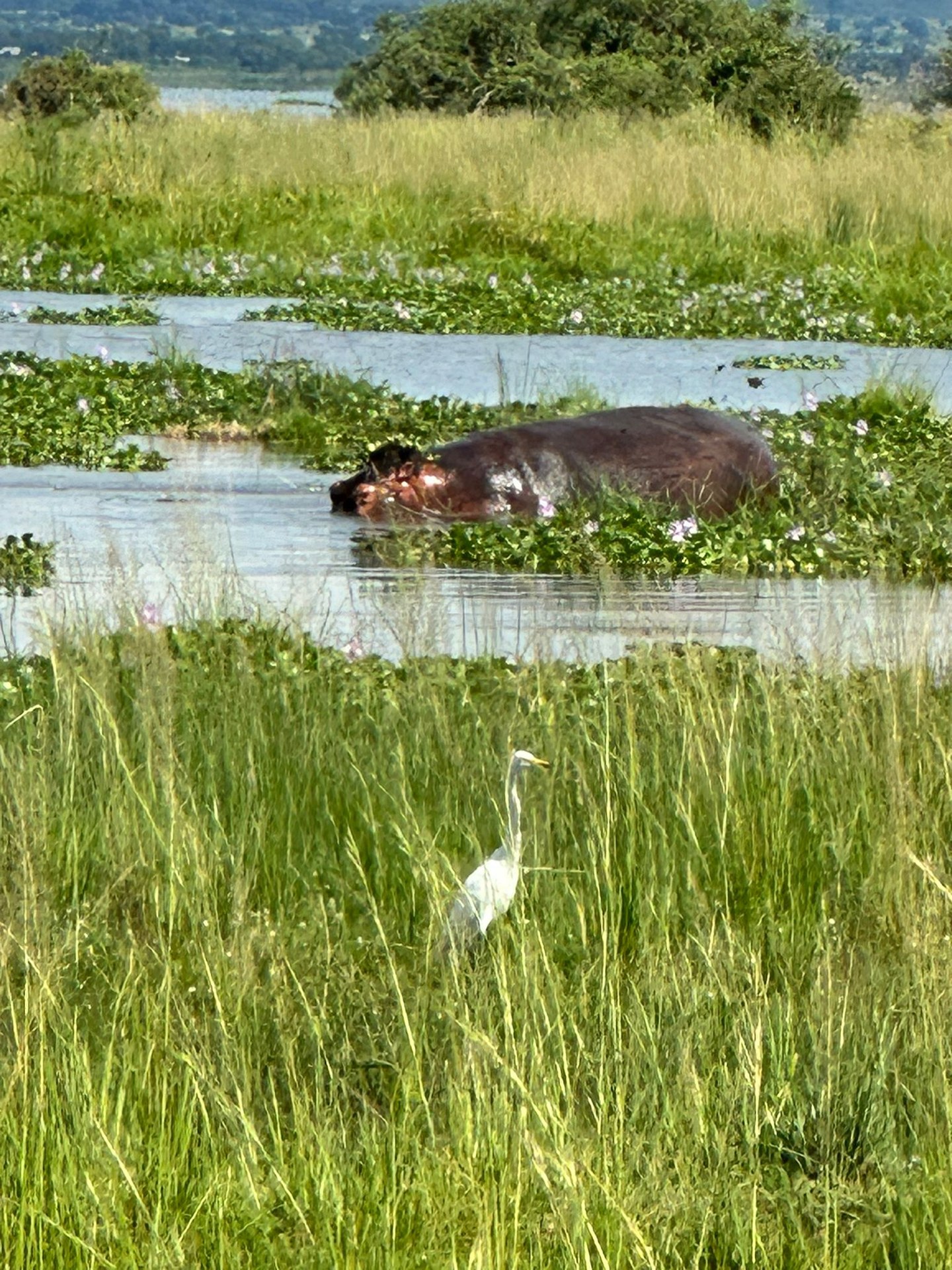
Western Uganda is the most wildlife-dense region of the country. Within a roughly 200 km radius of Fort Portal, visitors can track mountain gorillas in Bwindi Impenetrable National Park, chimpanzees in Kibale Forest, observe tree-climbing lions in Queen Elizabeth National Park, hike through afroalpine zones in the Rwenzori Mountains, and paddle among hippos on the Kazinga Channel. No other area in East Africa concentrates these experiences in the same space.
Fort Portal: The Gateway to Western Uganda
Fort Portal, the administrative centre of Kabarole District, is the practical hub for western Uganda travel. The town sits at around 1,500 metres above sea level on the edge of the Albertine Rift, with the Rwenzori Mountains visible on clear mornings to the north-west. Almost every attraction in the region is within a few hours' drive: Kibale National Park is approximately 35 km to the south-east, the Semuliki Valley is roughly 50 km to the west, and the Crater Lakes trail begins on the outskirts of the town itself.
The Crater Lakes district surrounding Fort Portal is one of the most visually striking landscapes in Uganda. More than thirty volcanic crater lakes, each with distinct water chemistry and colour, dot the Ndali-Kasenda area within a few kilometres of the town. Some are deep blue, others green or brownish, depending on algae and dissolved minerals. Walking trails connect several of the lakes, passing through tea estates and community land. During a January 2026 visit to the Fort Portal area, the morning views across the crater lake valley from the ridgeline above Ndali Lodge made clear why this landscape consistently draws visitors who have no particular interest in wildlife — it is simply an exceptional piece of East African scenery.
Kibale National Park: Chimpanzee Trekking and Forest Primates
Kibale National Park, gazetted in 1993 and covering approximately 795 km², protects a mosaic of tropical rainforest and woodland that supports the largest population of chimpanzees in Uganda. The park is the flagship destination for chimpanzee trekking in the country, and the Kanyanchu Visitor Centre near Kamwenge is the main departure point for morning and afternoon chimp tracking sessions.
Chimpanzees are large animals — adult males weigh up to 60 kg and stand roughly 170 cm when upright — and encounters in the forest are genuinely close. Habituated groups allow visitors to observe grooming, feeding, and social behaviour from a short distance under the supervision of Uganda Wildlife Authority guides. Kibale also holds significant populations of red-tailed monkeys, L'Hoest's monkeys, grey-cheeked mangabeys, and black-and-white colobus monkeys. The Uganda red colobus — a species endemic to Uganda and neighbouring countries, known scientifically as Procolobus tephrosceles— is particularly well represented in Kibale's forest.
The Bigodi Wetland Sanctuary, managed by a local community organisation adjacent to the park, extends the Kibale experience with a guided walk through papyrus swamp and riverine forest. It is one of the most rewarding birding walks in western Uganda, combining accessibility with genuinely high species density.
Queen Elizabeth National Park: Savanna, Channel, and Tree-Climbing Lions
Queen Elizabeth National Park, at approximately 1,978 km², covers the central Albertine Rift floor south of Fort Portal, encompassing savanna grassland, wetland, volcanic craters, and the shores of Lake Edward and Lake George. The Kazinga Channel, a 40 km waterway connecting the two lakes, is one of the most reliable wildlife viewing locations in Uganda. Boat safaris on the channel run from Mweya Peninsula and offer close approaches to large buffalo herds, hippo pods, Nile crocodiles, and an exceptional diversity of water birds — African fish eagle, African skimmer, pink-backed pelicans, and various heron species among them.
The Ishasha sector in the southern part of the park is the well-known location of Uganda's tree-climbing lions. Lions in most African parks rest on the ground; in Ishasha, they regularly climb into fig trees, particularly large Ficus natalensis, where they are often visible from game drive vehicles at close range. The behaviour is not fully understood — current evidence suggests it may relate to escaping insects or accessing shade and breezes — but it makes for an unusual and highly photogenic encounter. Game drives in the northern Mweya area cover open savanna with Uganda kob, Defassa waterbuck, topi, African elephants, and warthog.
Semuliki Valley: Lowland Rainforest and the Sempaya Hot Springs
Semliki National Park, approximately 50 km west of Fort Portal, protects 220 km² of lowland Congolian rainforest on the floor of the Albertine Rift. Geologically and ecologically, this forest is an extension of the Congo Basin rather than East Africa — its species composition reflects that origin, with a high proportion of West African and Central African endemics found nowhere else in Uganda. The park records more than 400 bird species and over 300 butterfly species, making it one of the most significant birding destinations in the country.
The Sempaya Hot Springs, within the park, are a distinctive natural feature: geothermal vents where the water temperature reaches approximately 106 degrees Celsius. The female spring, locally called Bintente, erupts in a column of boiling water several metres high. The trail to the springs passes through closed-canopy lowland forest and takes two to three hours round trip. The Semuliki River, which forms the border with the Democratic Republic of Congo, runs along the western edge of the park. The adjacent Maramagambo Central Forest Reserve, further south near Queen Elizabeth NP, contains the Python Cave — a large cavern with a substantial bat colony that has historically attracted resident rock pythons.
Rwenzori Mountains: Africa's Glaciated Range
The Rwenzori Mountains, known historically as the “Mountains of the Moon,” rise along the border between Uganda and the Democratic Republic of Congo directly west of Fort Portal. The massif holds Africa's third-highest peak: Margherita Peak on Mount Stanley, at 5,109 metres, with permanent glaciers on the upper slopes. Rwenzori Mountains National Park, covering approximately 1,000 km², was designated a UNESCO World Heritage Site in 1994 for its exceptional biodiversity and geological significance.
The trekking experience in the Rwenzoris is unlike any other in East Africa. Above the montane forest, the landscape transitions through bamboo zones into afroalpine heath, then into the iconic giant groundsel and giant lobelia zones that characterise the high Albertine Rift. These plants — some reaching six metres in height — are endemic to the equatorial African high mountains and create a landscape that looks unlike anything in the lowland parks. The standard central circuit takes six to nine days and does not require technical climbing; the summit routes to Margherita Peak require glacier equipment and certified guides. Rwenzori Mountaineering Services, based in Kasese, manages the hut network and guide programme.
Bwindi Impenetrable National Park: Mountain Gorilla Trekking
Bwindi Impenetrable National Park is the southern anchor of the western Uganda circuit. The park protects 321 km² of montane and lowland rainforest between 1,160 and 2,607 metres altitude and is the most significant gorilla habitat in Uganda. Mountain gorilla trekking requires a permit issued by Uganda Wildlife Authority ($800 per person in 2026), and visits are limited to one hour with each gorilla family per day, with a maximum of eight visitors per group. The park has four main sectors: Buhoma in the north, Ruhija in the east, and Rushaga and Nkuringo in the south.
Mountain gorillas are large, ground-dwelling primates with a gestation period of 250 to 290 days and a home range of 10 to 25 km². Groups are structured around one or more silverback males, with multiple females and their young. The habituated families at Bwindi have been visited by researchers since before the park's gazettal, giving visitors the opportunity to observe natural behaviour — foraging on leaves, shoots, bark, and bamboo — at close range in the gorillas' own forest environment. During visits to the Rushaga sector in October 2024 and January 2026, the treks ranged from one to four hours each way depending on the gorillas' position within their range that day. The hour in the presence of a gorilla family — at 3 to 10 metres distance in dense forest — is the kind of encounter that remains specific and detailed in memory long after returning home.
Lake Edward and the Albertine Rift Shore
Lake Edward, shared between Uganda and the DRC, sits on the floor of the Albertine Rift at approximately 912 metres altitude. Its northern shore falls within Queen Elizabeth National Park, and the fishing communities on the Ugandan side — particularly Katunguru and the villages along the Kazinga Channel — are part of the cultural landscape that visitors pass through on the way between Queen Elizabeth NP and Bwindi. The lake supports significant fish populations including the Nile tilapia and provides a livelihood for tens of thousands of people in Kasese and Kanungu districts. Hippos, crocodiles, and waterbirds use the lake shoreline throughout the year, and early morning boat trips from the channel provide access to these habitats away from the main Mweya boat safari route.
Planning a Western Uganda Itinerary
The logical routing for a western Uganda circuit begins in Kampala or Entebbe (approximately five to six hours from Fort Portal by road) and moves clockwise or anti-clockwise through the region's main attractions. A popular sequence runs Kibale Forest and Crater Lakes from Fort Portal, then south through Queen Elizabeth NP for game drives and the Kazinga Channel boat safari, then into the Ishasha sector for tree-climbing lions before crossing into Bwindi for gorilla trekking. The reverse is equally viable. The Rwenzori Mountains require a dedicated side trip from Kasese and should be planned as a standalone leg if trekking is the goal.
Road conditions in western Uganda vary. The main Fort Portal to Kasese road is tarmac and manageable year-round. The routes into Bwindi — both via Kabale to Buhoma and via Kanungu to Rushaga — include sections of unpaved road that require a 4WD vehicle, particularly in the wet seasons (March to May, October to November). Gorilla trekking itself always involves walking on steep, muddy forest terrain regardless of season; waterproof boots and gaiters are not optional.