Bwindi Impenetrable National Park Uganda — 321 km² of ancient montane rainforest in south-western Uganda, UNESCO World Heritage Site since 1994, home to approximately 459 mountain gorillas — is reached by a road that begins at Entebbe Airport, crosses the country's central plateau, climbs into the Albertine Rift highlands, and ends on an unpaved track that the locals call the Buhoma road. In May 2026, at GPS -0.9621°N, 29.6106°E in Buhoma, construction workers were fixing bright blue corrugated iron sheets to the completed timber frame of the HopeKitchen — a community facility built from handmade bricks that had been rising from the red earth for several months. The building was becoming enclosed, becoming useful. That moment of incremental completion, happening by hand in a village of several hundred people, captures something essential about how Bwindi Impenetrable National Park and the community alongside it actually work: slowly, materially, and with a dependency on income from visitors that makes every arriving tourist a structural part of the local economy.
During visits across October 2024, January 2026, and May 2026 — spanning more than ten days in and around Buhoma with GPS-verified positions ranging from -0.7871°N to -0.9794°N along the Bwindi approach corridor — what became apparent is that the Bwindi story has at least three distinct layers that most visitor guides do not address together. The first is legal: how Uganda's regulatory framework governs what tourism activity can happen in and around a national park and the forest reserves adjacent to it. The second is logistical: what the journey from Kampala to Buhoma involves, in roads, vehicle choices, time, and conditions that shift between seasons. The third is economic: what it means for an entire community to depend on a single wildlife product sold through a government permit system, and what that community does when the product becomes temporarily unavailable.
This article addresses all three. For the wildlife, the gorilla families, the trekking experience itself, and the biodiversity of the forest, see the related guides linked at the foot of this page. What follows is the framework that makes the Bwindi experience possible and the ground-level reality of the community that sustains it.
Bwindi Impenetrable National Park Uganda — Key Reference
- Area
- 321 km²
- Location
- Kanungu District, south-western Uganda, Albertine Rift
- Gazetted
- 1991
- UNESCO World Heritage
- 1994
- Mountain gorillas
- ~459 (2018–2020 census, Uganda Wildlife Authority)
- Share of global mountain gorilla total
- Approximately half
- Trekking sectors
- Buhoma, Ruhija, Rushaga, Nkuringo
- Gorilla permit (peak season)
- USD 800 per person
- Gorilla permit (low season)
- USD 450 per person
- Peak season months
- Jan, Feb, Jun–Sep, Dec
- Road distance Kampala–Buhoma
- ~472 km
- Road journey time
- 8–10 hours
- Managed by
- Uganda Wildlife Authority (UWA)
The Legal Framework: How Tourism Gets Permitted Near Bwindi
Bwindi Impenetrable National Park is a national park, not a forest reserve. The distinction matters legally, and understanding it explains why the cluster of lodges around Bwindi's four sectors looks the way it does: carefully positioned, formally approved, environmentally audited, and concentrated in specific locations rather than scattered along the forest edge.
Uganda manages two primary categories of protected forest land. Forest reserves fall under the Forestry and Tree Planting Act of 2003. Part 3 of that Act governs what activities are permissible within a forest reserve, including tourism. An operator wanting to run a tourism business within a forest reserve must obtain a licence from the National Forestry Authority, demonstrate that the proposed activity is compatible with the reserve's management objectives, and comply with attached conditions that typically restrict infrastructure footprint, visitor numbers, and impact on forest cover. Tourism is explicitly recognised as a permitted land use under the Act, but it operates within a framework designed to prevent the commercial use from undermining the conservation purpose. A forest reserve can accommodate tourism; it cannot accommodate tourism without accountability.
National parks, including Bwindi, sit under a parallel regime. The Uganda Wildlife Act gives the Uganda Wildlife Authority the power to issue concession agreements to operators wanting to run accommodation or activity businesses inside a national park boundary. Bwindi has relatively few in-park facilities — the terrain and the conservation constraints make in-park lodge construction difficult to justify — but where concession agreements exist, they carry employment conditions for local communities, conservation contribution requirements, and infrastructure specifications that go beyond generic planning standards.
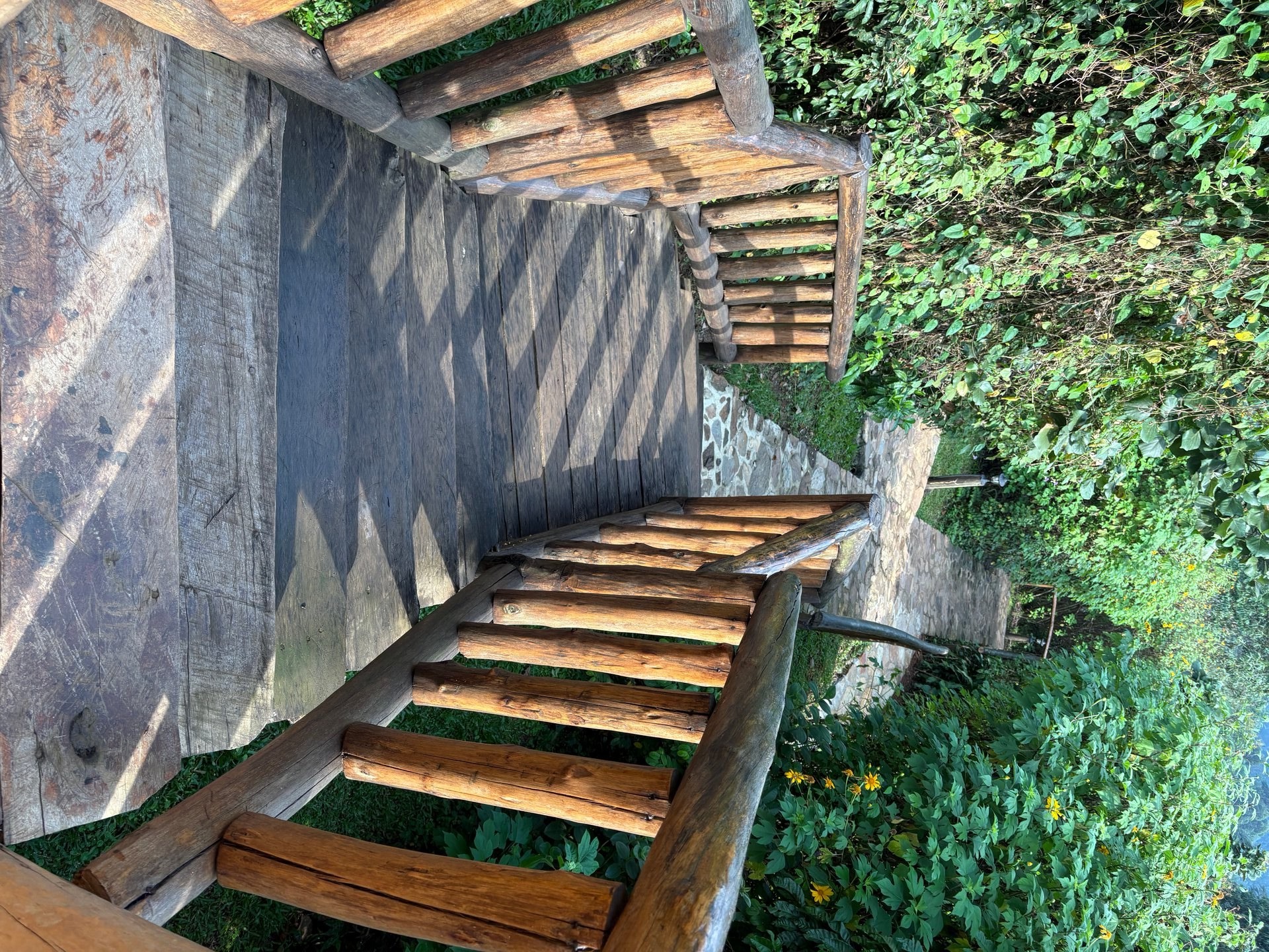
For the far more common category of lodge operating just outside the national park boundary — Gorilla Bluff Lodge in Buhoma at GPS -0.9794°N, 29.6168°E is one example, where the guest rooms are linked to the main house by steep handcrafted log stairs through secondary forest — the applicable framework combines three instruments. The Land Act (Cap 227) governs the underlying land tenure. The National Environment Act provides the general framework for environmental compliance. And specifically S.I. No. 47 of 2020 — the National Environment (Environmental and Social Assessment) Regulations — requires lodges, hotels, camps, and resorts near protected areas to complete an Environmental and Social Impact Assessment before construction begins and to submit compliance audits to the National Environment Management Authority every three years thereafter.
This regulatory architecture means that every established lodge in the Bwindi corridor represents a significant investment in legal process before a single room is built. Nkuringo Lodge in the southern sector, at 2,090 metres altitude with 18 guest rooms and registration with the Uganda Carbon Bureau under voluntary carbon standards, is an example of the additional voluntary layer that high-end operators in the Bwindi area have added to their statutory baseline. The statutory requirement is the floor; the market has pushed several operators well above it. The Uganda Tourism Board's 500-establishment hospitality inspection programme, conducted in 2024/25, assessed compliance with both quality and environmental standards across the national hospitality sector, and the Bwindi corridor — as Uganda's flagship conservation tourism zone — carries particular weight in that assessment.
The practical effect of this framework on the visitor experience is indirect but important. The barrier to entry it creates — substantial, time-consuming, and genuinely demanding — means that the lodge sector around Bwindi has grown in line with the park's carrying capacity rather than ahead of it. UWA's gorilla trekking rules set a hard ceiling of eight visitors per habituated group per day. The legal cost of establishing a new lodge naturally limits how many operators can profitably exist within that ceiling. The result is a lodge market that is premium-priced, limited in number, and correspondingly well-maintained — because operators have made too large an investment in approvals to cut corners on upkeep.
Getting There: The Road from Kampala to Bwindi Impenetrable National Park in Uganda
On arriving at Entebbe International Airport in January 2026 and being collected for the drive to Buhoma, the first substantial impression of Uganda came in Kampala — at GPS 0.2833°N, 32.4561°E on the Entebbe-Kampala corridor. The capital is dense with traffic in a way that is not chaotic but is uncompromising: multiple lanes of trucks, matatu minibuses, private vehicles, and boda bodas moving in fluid negotiation with each other, with roadside market stalls occupying the verge continuously for kilometres. Small shops, food vendors, hardware stands, and mechanics workshops line the road from the airport approach into the urban core. The city does not slow down for transit.
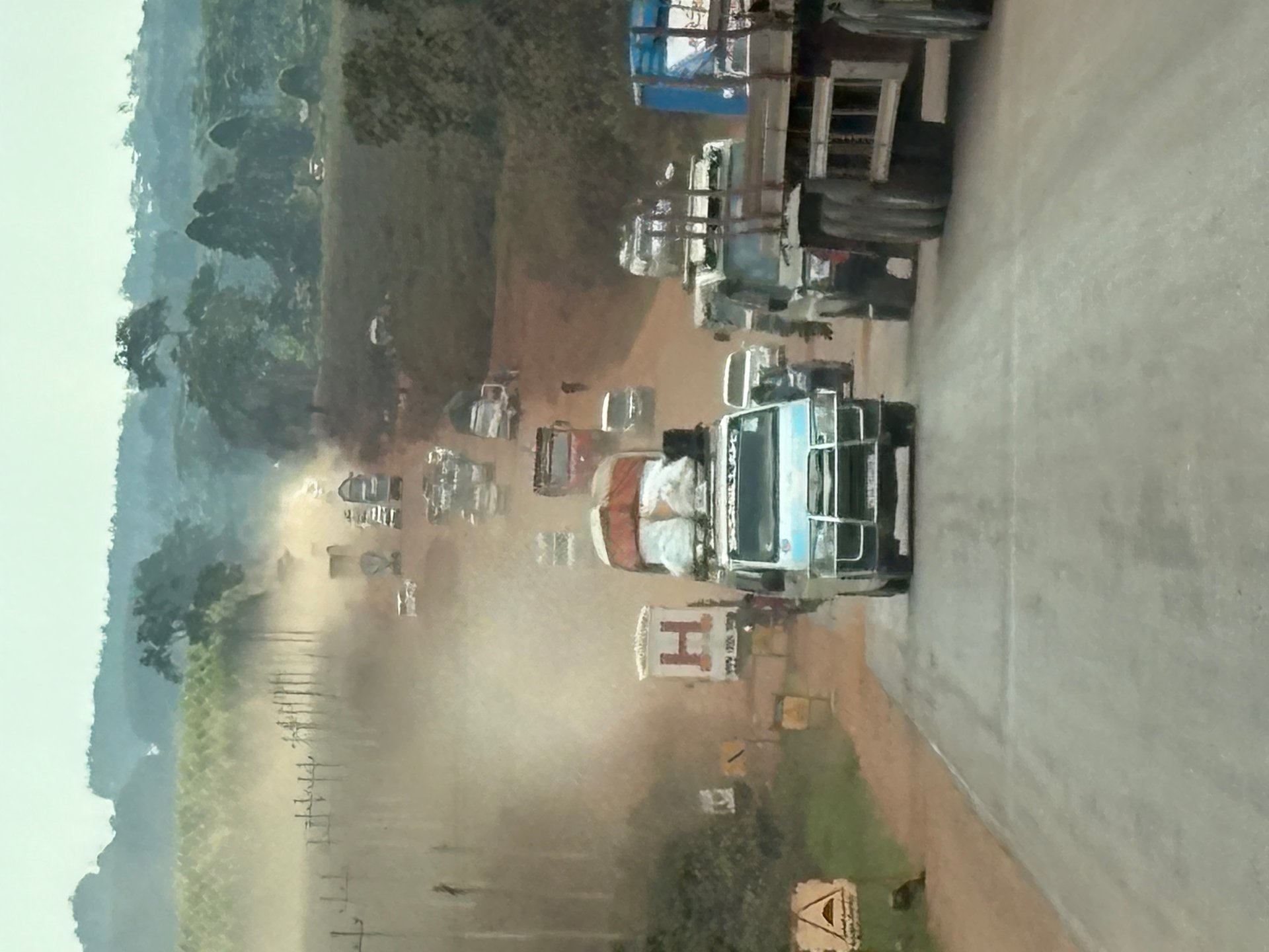
South-west of Kampala, the route to Bwindi follows the Masaka Highway. In January 2026, at GPS 0.1061°N, 32.1716°E, this road was under major reconstruction. Long sections had been stripped back to laterite earth in preparation for resurfacing, leaving an active road of compacted dust that heavy goods vehicles crossed at speed, raising visible dust plumes. The volume of commercial traffic using this route — tanker trucks, intercity buses, agricultural lorries carrying produce south toward Tanzania, private 4WDs, and a constant weave of boda bodas threading between them — makes the Masaka Highway read as an economic artery rather than a tourist route. It carries the commerce of half the country. Its reconstruction, even when disruptive, is evidence of sustained infrastructure investment in the corridor.
From Masaka the road continues south to Mbarara — a substantial town with fuel, food, and accommodation — then climbs into the highland landscape toward Kabale. Kabale sits at approximately 1,800 metres, in terraced hills that mark the beginning of the Albertine Rift highland zone. This is the last sizeable town before Bwindi, and most visitors who are breaking the Kampala journey overnight stop here or at Lake Bunyonyi, 20 kilometres west. From Kabale to Buhoma, the final 80 kilometres are unpaved murram road: compacted red laterite that is corrugated in dry conditions and becomes a vehicle test in wet ones. Gorilla Bluff Lodge and other Buhoma accommodation providers offer 4WD transfers from Kabale; self-driving visitors should be clear-eyed about what their vehicle can manage on this stretch.
The alternative to road travel is a domestic charter flight to Kihihi Airstrip, approximately 40 kilometres north of Buhoma. Airlines including AeroLink operate scheduled services from Entebbe on this route; flight time is under two hours. A road transfer from the airstrip to Buhoma adds 60 to 90 minutes. For visitors combining Bwindi with Queen Elizabeth National Park to the north — a standard itinerary pairing — Kihihi positions arrivals on the natural corridor between the two parks. Kisoro Airstrip, to the south, serves the Nkuringo and Rushaga sectors.
Inside Buhoma and its immediate surroundings, the transport picture changes completely. The boda boda motorcycle is the primary vehicle for everything: passenger trips, cargo haulage, water delivery. On a road visit in October 2024 at GPS -0.7871°N, 29.9268°E, a three-wheeled boda boda appeared — a customised cargo version with a red flatbed load area and a protective canopy over the driver's position, purpose-built for hauling goods on the rough tracks of the Bwindi approach. On a separate day, a standard boda boda was loaded with multiple large water jerrycans — an image that would not pass a road safety inspection in most countries, but which is a practical response to the absence of piped water supply across much of the rural area. The boda boda adapts to whatever needs transporting.
For tourists, the immediate transport question within the Bwindi area is the sector-to-sector connection. The four trekking sectors are separated by substantial distances on difficult roads: Buhoma in the north to Ruhija in the east is approximately two hours on murram tracks through the park interior; Ruhija to Rushaga or Nkuringo in the south is further still. A visitor who books permits in multiple sectors, or who is combining a Buhoma trek with accommodation elsewhere, needs a reliable vehicle and driver for the inter-sector transit. Local entrepreneurs in Buhoma have identified this gap. Norman, a Buhoma resident encountered during a visit in June 2026, runs a small transport operation and is building toward a more formal tourist driving service — organised vehicle hire with professional drivers oriented specifically at the foreign visitor market that currently has no consistently organised local option below the lodge transfer level.
[QUOTE: Norman on tourist transport demand in the Bwindi corridor]
Buhoma's Economy: A Community Built on a Single Tourism Product
Norman's assessment of Buhoma's economic structure is direct: the people here live from visitors. Not partially. Not as a secondary income alongside subsistence farming. The village in its current form — its lodges on the ridge above the park gate, its guiding community, its porterage cooperatives, its craft sellers, its boda boda operators positioned outside accommodation gates — exists because of the mountain gorillas in the forest and the UWA permits that give access to them. The gorilla trekking permit is not incidental to Buhoma. It is the village's economic foundation.
[QUOTE: Norman on what happens to Buhoma when tourists stop coming]
This dependency has direct and indirect expressions. The direct expression is the formal sector: lodge employment, UWA ranger salaries, park-licensed guides, the porterage cooperative whose members carry day-packs up to the forest for visitors at a fixed fee. The indirect expression runs through the rest of the local economy. The chicken farmer at the Nicholas orphanage compound supplies eggs and poultry to lodges. The small general shops — many of them women-operated establishments of roughly 20 square metres, selling soap, biscuits, water, and mobile phone credit — are stocked partly to meet the supplementary demand of lodge guests who have forgotten something or want something simple. The boda boda operators who haul water canisters and building materials during the week position themselves outside lodge gates on trek mornings, hoping for a transfer commission.
Community tourism diversification attempts to spread this dependency across a wider base of activities. The Buhoma Community Village Walk, operating from the community rest camp, charges $15 per person for a two-to-three-hour guided route through the village and surrounding farms. Ride 4 a Woman, founded in 2009 and headquartered on the main road near the park gate, runs guided mountain bike tours through the community landscape — ridge tracks, banana plantation routes, school visits — that give visitors a ground-level view of the agricultural and social environment the forest abuts. Revenue from these tours funds vocational training and education for women in the Buhoma community.
None of this diversification escapes the fundamental dependence on visitor arrivals. A village walk requires a visitor in the village. A bike tour requires a visitor willing to spend a non-trekking afternoon cycling. The diversified products sell to the same customer base as the gorilla permit — the person who has already decided to come to Bwindi. What they do is spread the economic benefit more broadly within the community, rather than concentrating it in the lodge sector. That is genuinely valuable, but it does not hedge the underlying risk: when arrivals fall, all income streams fall together.
That risk materialised in 2018, when an Ebola outbreak occurred in the Democratic Republic of Congo approximately 40 to 50 kilometres from the Bwindi boundary. Despite the outbreak remaining on the DRC side of the border and posing no direct public health threat to Buhoma, international advance bookings collapsed across the accommodation sector. The risk perception — Ebola, Africa, proximity — was sufficient. The economic contraction was immediate, affecting every layer of the Buhoma economy simultaneously. Lodge staff hours were cut. Guides had no bookings. Boda boda operators had no transfer work. The interdependence of the entire economic structure around a single external signal — the gorilla permit market — was made visible in real time.
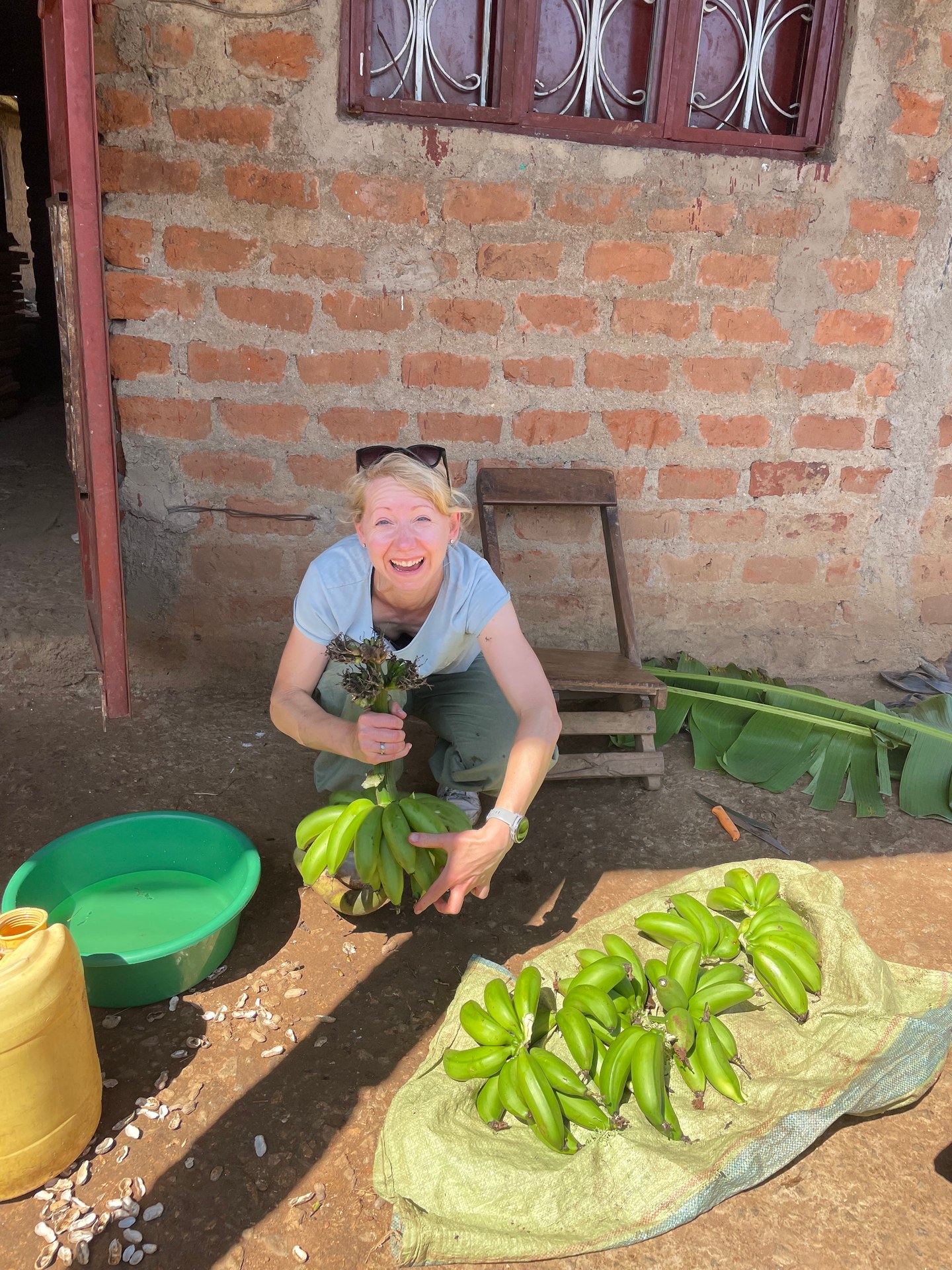
A stay at Gorilla Bluff Lodge in Buhoma during January 2026 made the micro-level texture of this economy tangible. The lodge at GPS -0.9794°N, 29.6168°E is built into a steep hillside, with guest rooms linked to the main house by log stairways carved from solid timber — a construction method that required local skilled labour and locally sourced materials. Breakfast on the morning of the gorilla trek was fresh fruit from nearby farms: banana, melon, and mango, brought to the lodge by small-scale producers who form part of the agricultural supply chain that tourist accommodation sustains. The revenue from a lodge night at Gorilla Bluff passes, through wages and procurement, directly into the Buhoma community economy. This is the micro-level expression of the macro-level principle that makes gorilla tourism work as a conservation mechanism: the gorillas alive in the forest are worth more to the Buhoma community than they would be in any alternative land use scenario. That alignment of incentives is the actual engine of conservation here, more than any regulatory framework.
Uganda's Regional Tourism: Where Bwindi Impenetrable National Park Sits in the National Picture
Uganda's tourism economy is geographically concentrated. Hotel occupancy data from the Uganda Tourism Board's 2022-23 annual report maps arrivals and revenue by region, and the pattern it reveals is pronounced concentration in the south-western corridor — the area containing Bwindi Impenetrable National Park, Mgahinga Gorilla National Park, Queen Elizabeth National Park, and Lake Bunyonyi. This concentration reflects the flagship product: mountain gorilla trekking is the primary reason international visitors come to Uganda, and almost all gorilla trekking in Uganda happens in this corridor.
Other regions have strong offerings. The eastern region around Sipi Falls and Mount Elgon offers mountain hiking, coffee farm tours, and birdwatching with an international visitor base that is growing but smaller. The northern region, anchored by Kidepo Valley National Park, attracts visitors seeking wilderness exclusivity — a park with significant wildlife density and very low visitor numbers, by both design and distance from Entebbe. The central region, including Kampala, generates urban tourism with a domestic and business visitor base; the Uganda Tourism Board promoted 17 significant tourism events in Kampala during 2023-24, including the Rolex Festival and Miss Tourism Uganda, attracting a combined digital audience through the Kampala tourism web portal of over 300,000 visitors.
None of this matches the revenue weight of Bwindi. A single gorilla trekking permit at $800 generates more visitor spend in one transaction than most other Ugandan tourism products produce in multiple visits. Multiply that by the number of habituated gorilla groups, the number of permits issued daily across four sectors, and the multiplier effect of the associated accommodation and service spending, and the economic significance of Bwindi Impenetrable National Park within Uganda's overall tourism economy becomes clear. It is not simply a popular destination. It is a disproportionate revenue generator for its geographic size and visitor throughput.
The seasonality pattern of the south-western corridor drives the hotel occupancy figures for the entire Bwindi area. Peak season — January, February, June through September, December — corresponds to the driest, most accessible trekking months. Low season — April, May, November — sees substantially lower occupancy. UWA's reduced permit price of $450 during low season is a demand management mechanism designed to spread visitor load across the year and provide some income continuity to the lodge and guiding sector. For budget visitors willing to accept muddier trails and a greater chance of rain, the low season months offer the same encounter with the gorillas at roughly half the peak price.
Uganda's national capital is receiving substantial public tourism infrastructure investment: a UGX 6 billion project for tourism facilities in the Greater Kampala Metropolitan Area runs from 2025/26 to 2029/30, funded through the Kampala Capital City Authority. This investment targets urban infrastructure — roads, parks, historical sites, accommodation facilities — in the capital zone. It does not directly address the infrastructure constraints most relevant to Bwindi visitors: the murram road from Kabale to Buhoma, the power supply limitations that require lodges to run diesel generators, the water infrastructure that determines whether community facilities like the HopeKitchen in Buhoma serve their intended function year-round.
The relevant public investment for Bwindi's community is UWA's community revenue sharing programme, which routes a defined percentage of national park receipts — including gorilla permit fees — to boundary communities as block grants for community-determined projects. Schools, health facilities, water points, and community infrastructure have been built across the Bwindi boundary communities using revenue sharing funds since the programme's inception. The HopeKitchen in Buhoma draws on a combination of NGO funding and community contributions rather than revenue sharing specifically, but it exists in the same ecosystem that revenue sharing has helped build: a community that is economically engaged with its park rather than alienated from it, and that therefore has an active stake in the conservation of the forest.
That stake is the deepest layer of the Bwindi model. In conservation terms, Uganda's approach to Bwindi Impenetrable National Park has been vindicated by the mountain gorilla population numbers: approximately 300 individuals in the late 1990s, rising to the 459 confirmed by the Uganda Wildlife Authority's 2018-2020 census. That recovery happened not because Bwindi was sealed off from human activity but because the communities around it were given a tangible economic reason to protect what was inside it. The forest, in Buhoma, is not the enemy of the community. It is the community's primary asset.