A Shop in Buhoma: Where Water Becomes Visible
During my visit to Bwindi in January 2026, I stopped at a small shop directly on the main road through Buhoma. The store was perhaps twenty square metres, its goods arrayed behind a metal security grille — the kind of light protection that acknowledges both the value of the inventory and the trust that exists within a small community. The owner, like the majority of shopkeepers in Buhoma, was a woman. She sold packaged sweets, snacks, and plastic-bottled water. I bought sweets for the children who gathered outside and water for myself. That single transaction — water purchased from a shelf inside a village store, GPS-tagged at –0.97° N, 29.61° E — compressed an entire question into a small moment: where does this water come from, and what keeps it available?
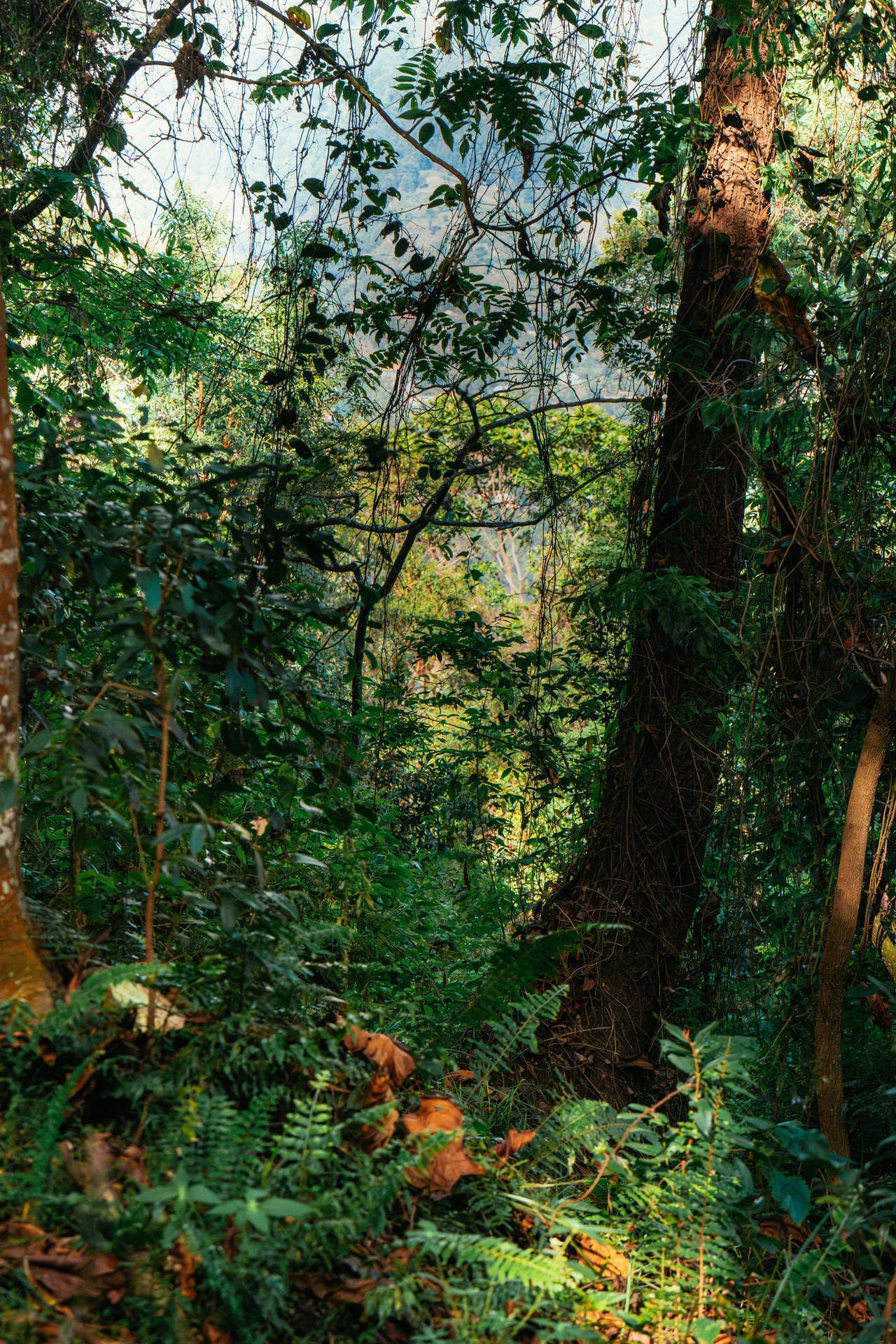
In Buhoma, the answer runs uphill. The water that arrives in plastic bottles on those shelves originates, directly or indirectly, in the hydrological system maintained by Bwindi Impenetrable National Park, which begins almost at the edge of the village. Springs feed from groundwater recharged by forest soils. Rivers carry flows sustained through dry periods by the slow release of water absorbed during wetter months deep within the park. The forest, in this sense, is not a park that happens to border a village. It is the upstream infrastructure that makes reliable water access in that village possible.
Understanding water security in the Bwindi region means understanding this connection — and then understanding how climate change, deforestation pressure, and land-use decisions upstream are beginning to alter it. The stakes are not abstract. They are measured in spring flows, crop harvests, and the daily routines of hundreds of thousands of people across southwestern Uganda.
How the Forest Produces Water
Bwindi Impenetrable National Park covers 321 square kilometres of intact montane forest, rising from roughly 1,160 metres above sea level at the park's lower margins to 2,607 metres at its highest ridges. This elevation range places the park directly within the cloud and mist belt of the Albertine Rift escarpment, where moisture does not arrive only as rainfall. The dense forest canopy strips water vapour from low cloud and mist, depositing it as fine droplets onto leaf surfaces, mosses, and epiphytic plants. This process — known as horizontal precipitation or cloud stripping — adds a measurable volume of water to the forest system that does not appear in standard rainfall records.
Standing on a ridge trail in the early morning, as I did during visits in October 2024 and again in January 2026, the effect is immediate and sensory. The canopy drips with a regularity that has nothing to do with rain. Water runs down bark, channels along the undersides of large leaves, and falls steadily onto soil that is already saturated with centuries of accumulated organic matter. The forest floor — deep in decomposing leaves, root networks, and fungal mats — absorbs this water at rates far exceeding those of agricultural land, grassland, or bare soil. It then releases that water slowly, through seepage into groundwater reserves and through the gradual drainage that feeds the park's rivers.
Five major rivers drain Bwindi westward through the Albertine Rift: the Ishasha, Ntungwe, Mubwindi, Kivu, and Kanyamahane. These are not small streams. They carry year-round flows into the lowland river systems that cross the rift floor toward Lake Edward. Their reliability depends on the forest maintaining its sponge-like absorption capacity. Where forest is intact, rivers run clean and relatively steady throughout the year. Where forest has been converted to farmland at the park margins, adjacent streams show the characteristic pattern of degraded catchments — high and turbid after rainfall events, falling sharply when rain stops, and unreliable through dry periods.
Climate Change: Shifting Rainfall, Rising Temperatures
Southwestern Uganda historically receives rainfall in two distinct wet seasons: a longer rains period from March to May, and a shorter season from September to November. This bimodal pattern has structured agriculture, grazing calendars, and water management across the region for generations. It is this pattern that is now under stress.
Observed trends across the Albertine Rift region include later onset of the long rains season, more frequent multi-week dry spells within wet periods, and an increasing proportion of annual rainfall arriving as high-intensity events rather than the moderate, sustained rainfall that allows the soil to absorb and retain water effectively. Higher temperatures compound these shifts by increasing evapotranspiration — the combined loss of water from soil surfaces and plant leaves — meaning that even where total annual rainfall remains within historical ranges, effective moisture available for plant growth and groundwater recharge is reduced. Warmer air holds more moisture before it precipitates, which can mean longer dry periods followed by more concentrated rain events.
For the forest itself, these changes represent a significant physiological challenge. Montane forests like Bwindi are adapted to specific temperature and moisture regimes. Mountain gorillas, which depend on the forest's vegetation structure for food and shelter, are also adapted to the cool, mist-shrouded conditions of high-altitude tropical forest. Research into how climate change will affect the elevational distribution of suitable gorilla habitat indicates that as temperatures rise, some lower-altitude forest zones may become less suitable, while higher-altitude areas face their own pressures from changing precipitation and increased fire risk during extended dry periods. The forest is not a static backdrop; it is a system responding, unevenly and with uncertain outcomes, to a climate that is changing faster than at any point in its recent ecological history.
One measure of the forest's own vulnerability to climate stress is the condition of its endemic plant species. The Rotheca violacea subsp. kigeziensis, globally classified as Critically Endangered, is endemic to the Kibale Forest and areas on Mulole Hill near Bwindi. This plant's extreme range restriction means that any degradation of its specific microhabitat — whether from climate-driven shifts in moisture, temperature, or from direct human disturbance — carries an immediate extinction risk. Species with ranges this narrow are the canary in the coalmine for the broader forest system.
Communities on the Water Line
More than 500,000 people live in the parishes surrounding Bwindi. Their relationship to the park's water system is not mediated by policy documents or conservation theory — it is experienced daily, through the springs that supply household water, the streams that irrigate kitchen gardens, and the seasonal floods and droughts that determine whether a harvest is good or poor.
Water collection in many communities bordering the park remains a significant daily burden, particularly for women and older children who are typically responsible for it. Springs are the primary source for many households: natural seeps where groundwater emerges at the surface, often developed with a simple concrete apron and pipe to improve reliability and hygiene. These springs are directly dependent on the groundwater reserves sustained by the forest above them. When forest cover at the park margins thins — through legal and illegal encroachment, charcoal production, or clearing for agriculture — the recharge capacity that sustains those springs is reduced. Springs that ran reliably through previous dry seasons have shown reduced flow or seasonal failure in areas where adjacent forest cover has been compromised.
Food security in the region is bound tightly to these water dynamics. Smallholder agriculture across the communities surrounding Bwindi is predominantly rain-fed. Beans, maize, sorghum, and banana gardens require the kind of well-distributed seasonal moisture that the bimodal rainfall pattern, when it functions reliably, provides. When the onset of rains is delayed, planted seed germinates weakly or not at all. When the rains end early, crops that have formed but not matured fail in the field. When intense rainfall events follow dry spells, erosion strips recently planted slopes and carries topsoil — and the seed with it — into streams. The link between water and food in this context is not a metaphor. It is a direct agricultural mechanism operating at the scale of individual households.
[QUOTE: local guide on how dry seasons have changed in their experience]
Rainfall and food security are also connected through livestock. Cattle, goats, and smaller animals kept by communities around Bwindi require reliable water access and pasture. In periods of extended drought, pasture quality degrades rapidly on the sandy soils common to parts of the rift escarpment, and open water sources diminish. Livestock condition falls, productivity drops, and animals that represent significant household economic value — a form of savings and insurance — face increased mortality risk. The forest's role in sustaining water availability through dry periods is therefore also a form of economic security for pastoral and agropastoral households.
Corridors, Connectivity, and the Wider Watershed
Bwindi does not exist in hydrological isolation. It is part of a network of forest blocks across the Albertine Rift that together function as the water tower for an enormous area of East and Central Africa. Kibale National Park, located to the north of Bwindi and known primarily as the site of the world's highest density of chimpanzees, is part of the same forest arc. The rivers and groundwater systems that these parks generate connect through river corridors and valley wetlands to Lake Edward, Lake George, the Kazinga Channel, and ultimately to the Nile system.
The wildlife corridors that link these forest blocks — strips of woodland and scrub that allow elephants, chimpanzees, and other wide-ranging species to move between parks — also perform hydrological functions. Forested corridors slow runoff, stabilise stream banks, and maintain groundwater connectivity across the agricultural landscapes that separate major protected areas. The documented disruption of elephant and chimpanzee corridors connecting Budongo-Bugoma and Kibale-Bwindi forests through tourism and infrastructure development has consequences beyond wildlife movement: it interrupts the hydrological connectivity that those forest strips sustained.
NatureUganda, which has conducted systematic bird monitoring in the region including at Ssele Islands since 2006, provides one of the longer continuous datasets on the ecological condition of freshwater and wetland habitats in this broader landscape. Waterbird populations are reliable indicators of catchment health, since they integrate information about water quality, fish populations, aquatic vegetation, and hydrological regime into a single, observable metric. Long-term monitoring data from NatureUganda has documented the kinds of change in waterbird distribution and abundance that signal broader shifts in the health of the water systems feeding Lake Edward and the Albertine Rift wetlands.
Bwindi and the Echuya Forest Reserve together constitute the most important remaining habitat for a cat species listed as endangered on the Uganda Red List. The presence of this species in these two protected areas is itself an indicator of the ecological integrity of forest patches that are also critical for water security: areas healthy enough to support a forest-specialist carnivore are, by definition, areas where the forest is still functioning as a forest, with intact soil, vegetation structure, and hydrology. Conservation of these areas for biodiversity and conservation of them for water security are not competing objectives. They are the same objective, viewed from different angles.
What Protection Looks Like in Practice
The Uganda Wildlife Authority maintains active management across Bwindi and the adjacent Mgahinga Gorilla National Park, including a sixteen-kilometre stone wall in Mgahinga designed to prevent gorillas from raiding crops in adjacent community gardens. This wall is a physical embodiment of the tension that exists at every point where the park meets farming communities: the need to protect both the wildlife within and the livelihoods just outside. The same border that defines the limit of park protection also marks the upstream edge of the community water system.
Effective management of Bwindi as a water system means maintaining the integrity of that boundary — not only through enforcement of park regulations, but through the community benefit-sharing mechanisms and livelihood support programmes that make conservation compatible with local economic reality. When park-adjacent communities see direct benefit from the forest's existence — through tourism employment, community conservation fund revenues, and the ecosystem services of which water is among the most tangible — the social contract that underpins protection is stronger. When those benefits are absent or invisible, the pressure to encroach on park margins for farmland or charcoal is harder to resist.
Climate change makes this already complex balance more demanding. As rainfall becomes less predictable and agricultural yields more variable, the economic pressure on forest margins tends to increase, precisely when the forest's buffering function is most needed. Communities that are food-insecure are less able to absorb the costs of conservation compliance. The dynamic is not a simple conflict between conservation and development; it is a set of interconnected pressures that require integrated responses — ones that treat water security, food security, and forest conservation as dimensions of the same challenge rather than competing priorities.
For visitors arriving in Buhoma, as I have done across multiple visits between October 2024 and June 2026, the forest that begins almost at the edge of the village is never just scenery. It is active infrastructure. It is producing, right now, the water that flows through the pipes and fills the bottles on the shop shelves. Understanding that connection — between the intact montane forest on the ridge, the springs in the valley, the water in the plastic bottle, and the woman running the small shop on the roadside — is understanding what conservation in this part of the world is actually for.