A Boundary Under Constant Pressure
Bwindi Impenetrable National Park covers 321 square kilometres of ancient montane rainforest in southwestern Uganda. It is one of the most biologically significant patches of forest on the African continent — and one of the most isolated. On virtually every side, the park’s boundary is pressed against some of the most densely populated agricultural land in East Africa. The contrast at the edge is stark: old-growth forest on one side, cultivated fields and homesteads on the other, with only a line on a map and a patrol track between them.
This situation did not emerge overnight. The Kigezi highlands that surround Bwindi have been farmed for generations, and population density in the region continues to rise. The park itself was formally gazetted in 1991, converting what had previously been a forest reserve into fully protected land and curtailing the subsistence access that communities had long relied on. The result is enduring pressure along the entire boundary — pressure expressed not only as deliberate encroachment but as the cumulative consequence of land use on adjacent slopes: deforestation, soil degradation, and accelerating erosion.
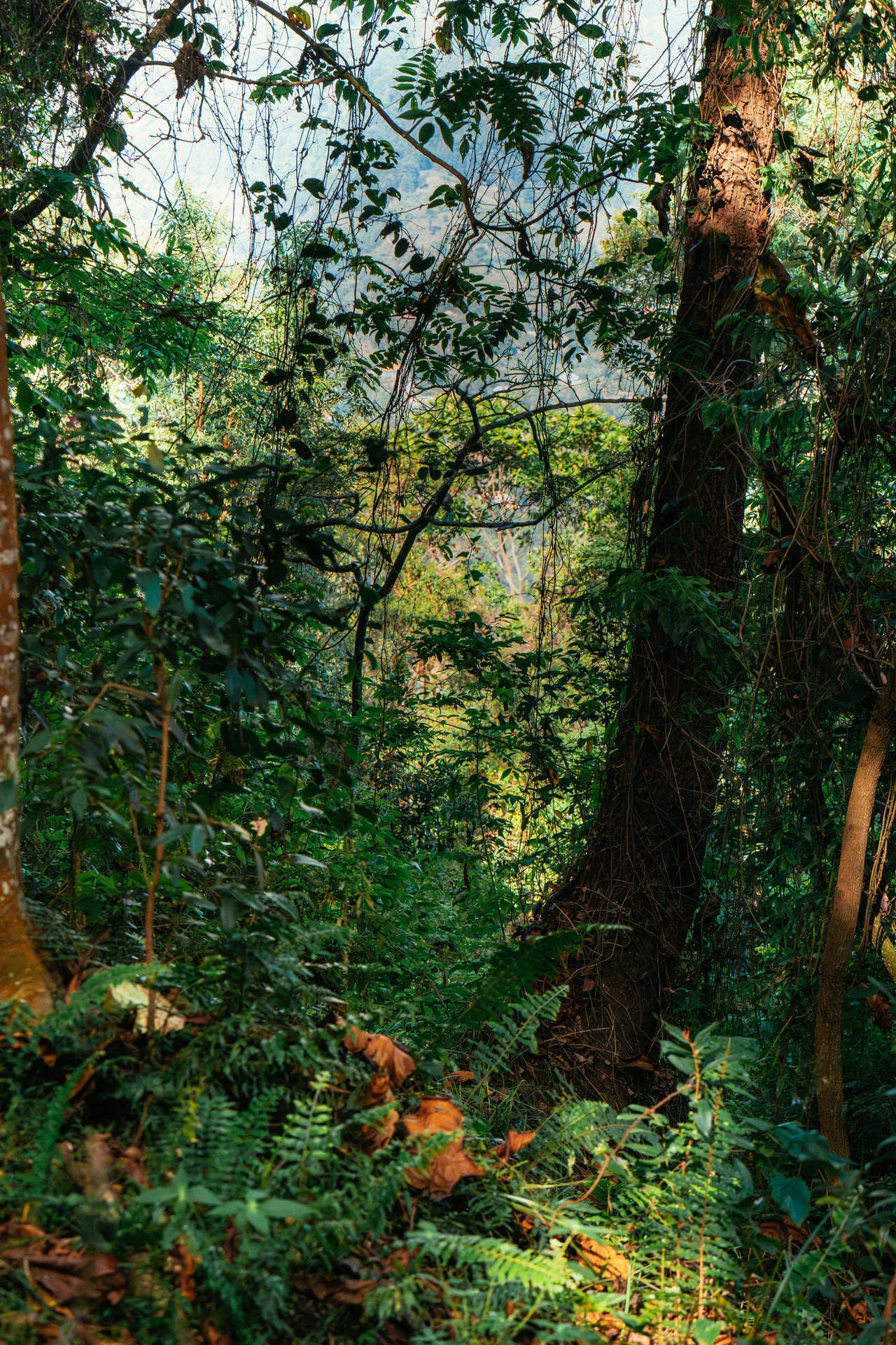
During two visits to Bwindi in January 2026, the contrast at the park edge was immediately apparent. Within the park, the air is noticeably cooler and more humid. Step outside, and the landscape shifts abruptly to open hillsides of cultivated plots, tea estates, and small-scale banana gardens. The forest does not taper off gradually — it ends. That sharp edge is itself an ecological problem.
What Deforestation Does to a Forest's Edge
A standing forest is more than the sum of its trees. It functions as a system that moderates temperature, retains moisture, stabilises soil, and recycles nutrients through tightly coupled biological processes. When the forest outside a park boundary is removed, those processes do not simply stop at the boundary line. The ecological conditions inside the park are altered, often in ways that compound over years before becoming visible.
The most immediate effect is the creation of a sharper, more exposed forest edge. Trees at the margin are suddenly subjected to wind speeds, temperature extremes, and reduced humidity that interior forest trees never experience. Canopy trees at the boundary are more vulnerable to windthrow — being uprooted or broken by gusts that would have been buffered by surrounding forest. When a large boundary tree falls, it opens a gap that allows more wind and light to penetrate further inward, accelerating the degradation of a progressively wider edge zone.
Invasive plant species, which tend to colonise disturbed and open habitats, exploit these newly created gaps. They establish themselves in light-rich edge environments and then advance inward along the damage corridors created by fallen trees. Once established, some invasives can suppress native seedling regeneration, effectively preventing the forest from recovering even where disturbance pressure is reduced. Bwindi’s integrity depends on the forest regenerating continuously from within; anything that disrupts that process represents a long-term structural threat.
The disruption of wildlife corridors compounds these pressures. According to the State of Wildlife Resources in Uganda 2026, the corridors linking Budongo and Bugoma forests, and those connecting Kibale to Bwindi, have been disturbed by infrastructure development. For mountain gorillas — whose population is monitored continuously and numbered 459 individuals in Uganda across the 2018–2020 census period — corridor integrity is not merely an ecological abstraction. It determines whether genetic exchange between populations is possible over the long term and whether gorillas displaced by disturbance within one part of their range can relocate safely.
Erosion Dynamics on Tropical Hillsides
The terrain surrounding Bwindi is structurally predisposed to erosion. The park sits on the rim of the Albertine Rift, and the slopes descending from its boundary are steep, often exceeding 30 degrees. In a landscape where those slopes are covered with forest, the erosion risk is manageable: tree roots bind the soil, leaf litter absorbs raindrop impact before water reaches bare earth, and the forest floor’s high organic content allows rapid infiltration. Remove the forest, and all of those protective mechanisms disappear simultaneously.
Tropical rainfall intensifies the problem. Unlike the steady precipitation of temperate climates, Bwindi’s rainfall frequently arrives in short, intense convective storms. Individual events can deliver 50–80 millimetres in a few hours. On a bare cultivated slope, this kind of rainfall generates immediate surface run-off. Water does not infiltrate fast enough; it flows downhill in sheets, picking up soil particles as it moves. Where run-off concentrates into channels, gully erosion begins — a self-accelerating process in which each rainstorm deepens the gully and increases the volume of water and sediment it carries.
The sediment mobilised by these processes does not stay on the farm. It moves downslope into valley-bottom streams, many of which flow into or through the park. Rivers in Bwindi serve as water sources for gorillas and other wildlife; several are also critical for downstream communities. When sediment loads increase, turbidity rises, water temperature fluctuates more widely, and the invertebrate communities that aquatic animals depend on are disrupted. In extreme events, debris flows — fast-moving mixtures of water, soil, and vegetation fragments — can physically reshape stream channels, alter valley-bottom habitats, and block patrol routes within the park.
The loss of topsoil also feeds a broader poverty-conservation spiral. As farmland on the steeper slopes degrades, per-hectare food production declines. Families facing food insecurity have stronger incentives to extract resources from the park — gathering non-timber forest products, setting snares, or clearing forest edges to bring new land into cultivation. Between 2020 and 2025, non-timber forest product extraction incidents in Bwindi Impenetrable National Park ranged from 20 to 60 documented cases per year, according to the State of Wildlife Resources in Uganda 2026. Each incident represents not only a legal violation but evidence that subsistence pressure on the park’s resources has not abated.
Gorillas at the Margin
Mountain gorilla populations in Bwindi have been monitored continuously since 2011, providing one of the longest-running wildlife datasets on the African continent. The data reveal a cautiously positive trend: numbers in Uganda have grown steadily despite the pressures described above. That growth, however, does not mean the underlying threats have been resolved — it reflects the effectiveness of intensive protection, veterinary support, and community engagement programmes. Remove those interventions, and the picture would be different.
Gorillas are not uniformly distributed across Bwindi’s 321 square kilometres. Different family groups occupy different sectors of the park, each with a home range shaped by food availability, water sources, and social history. Several habituated families — those accustomed to human presence for tourism and research — have home ranges that overlap or abut the park boundary. These families are the ones most likely to venture outside the park in search of food, particularly during periods when favoured plant species are fruiting near the edge or when competition within the park is high.
Gorillas that cross the boundary enter a landscape where they encounter human communities, cultivated crops, and the stresses of an open environment. Crop raiding, when it occurs, damages livelihoods and generates negative attitudes toward conservation that can be difficult to reverse. Physical barriers have been used in adjacent parks to manage this problem: in Mgahinga Gorilla National Park, Uganda Wildlife Authority maintains a 16 kilometre stone wall to reduce the incidence of gorillas and other wildlife moving into farmland. Bwindi’s longer and more complex boundary presents a harder engineering challenge, making land-use planning and community-based deterrents more important tools.
The edge habitat that gorillas traverse when they move between the park interior and the boundary is also where erosion effects are most pronounced. Unstable slopes, reduced canopy cover, and modified microclimates make these marginal zones less hospitable and nutritionally less productive than the park interior. As deforestation outside the park continues, the quality of this transition zone degrades, effectively narrowing the functional habitat available to boundary-ranging gorillas.
What Protection Measures Exist
Conservation at Bwindi operates on multiple levels simultaneously. At the boundary, Uganda Wildlife Authority rangers conduct daily patrols and monitor gorilla movements. The revenue-sharing programme, which channels a portion of permit fees — currently US$10 per permit — to community development projects in adjacent parishes, provides a tangible economic link between park health and local welfare. Communities that benefit from this income have material reasons to support park protection rather than oppose it.
Buffer-zone arrangements formalise negotiated access rights for specific non-timber forest products in designated areas. This approach attempts to reduce illegal extraction by providing a legal channel for communities to meet genuine subsistence needs while limiting the overall pressure on the park interior. The system is imperfect — documented incidents of extraction outside permitted areas confirm that demand often exceeds what the formal scheme accommodates — but it represents a more sustainable approach than simple exclusion.
Landscape-level restoration programmes address the underlying driver of erosion by replanting degraded slopes outside the park with native tree species. When woody cover is re-established on steep hillsides, run-off rates decline, erosion slows, and the ecological transition between the park interior and the surrounding farmland becomes less abrupt. NatureUganda and other conservation organisations active in the region monitor species that serve as indicators of ecosystem health across both the park and its surrounding landscape.
Bwindi is also notable for the range of species that depend on it beyond gorillas. Together with the Echuya Forest Reserve to the south, it forms one of only two protected areas in Uganda identified as a critical stronghold for an endangered felid on the Uganda Red List of 2026. This broader biodiversity value reinforces the case for treating the forest not as a single-species reserve but as a functioning ecosystem whose integrity depends on what happens both inside the park and on the land immediately surrounding it.
The Compounding Logic of Forest Loss
The core problem with deforestation and erosion as conservation threats is that they operate slowly, incrementally, and largely out of sight. A landslide is visible and dramatic; the gradual thinning of topsoil across a thousand smallholder plots is not. A gorilla family venturing into a crop garden makes headlines; the slow inward advance of the edge-effect zone through the forest margin goes unnoticed. But it is the accumulation of these incremental changes that ultimately determines whether the forest can sustain the populations that depend on it.
Mountain gorilla conservation has achieved genuinely significant results at Bwindi. Population monitoring running continuously since 2011 documents real growth, and the commitment of Uganda Wildlife Authority, international partners, and local communities to that outcome is not in doubt. What the long-term population trajectory will look like depends not only on what happens inside the park — veterinary care, anti-poaching patrols, tourism management — but on whether the broader landscape around Bwindi can be stabilised well enough to prevent the edge-degradation spiral from narrowing the functional habitat further with each passing decade.
Visiting Bwindi in January 2026 and walking to the park boundary in the Buhoma sector made this dynamic concrete rather than abstract. The forest behind you is dense, layered, and alive with sound. The hillside in front of you is cultivated from the valley floor to the ridge. The line between them is immediate and unambiguous. What is harder to see — but no less real — is the biological conversation happening across that line, and the degree to which the future of the gorillas depends on managing both sides of it.