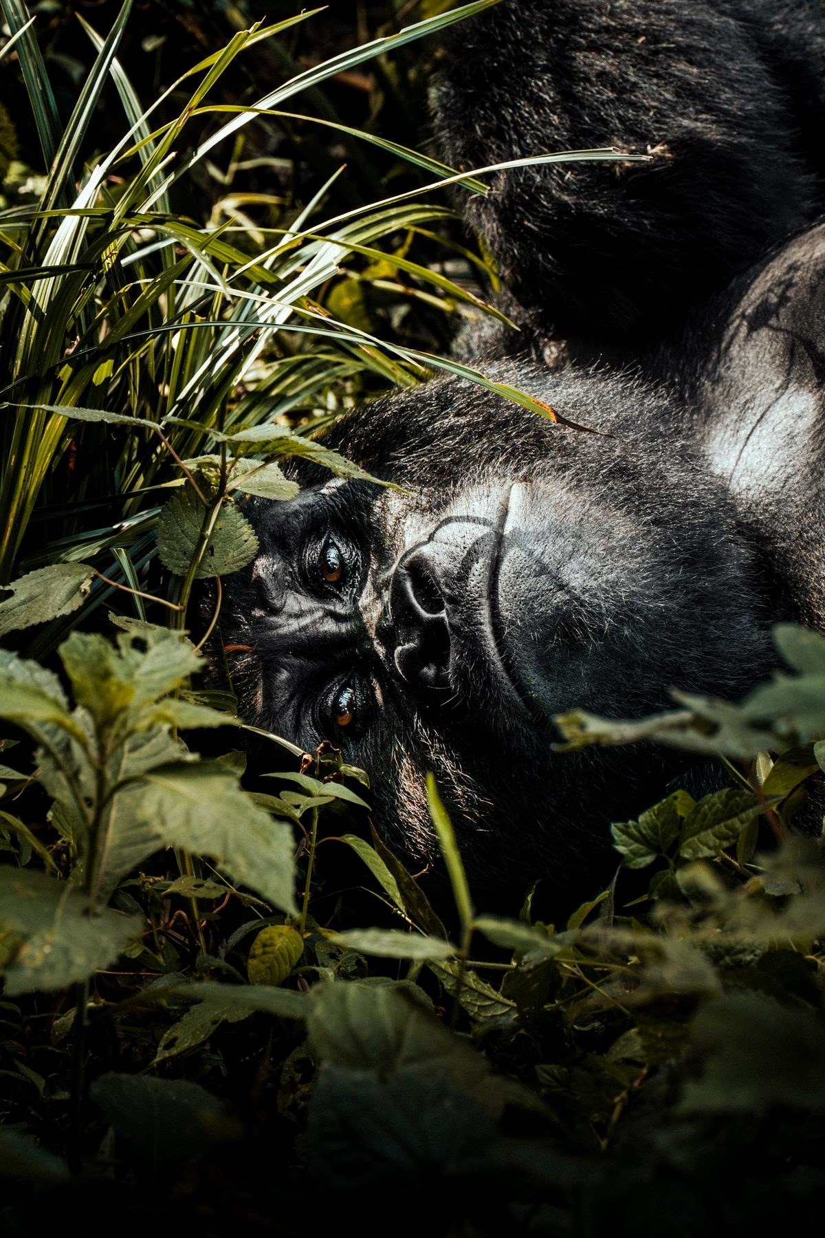
A Global Number with a Very Local Consequence
Scientific assessments of global land cover have identified approximately 2 billion hectares of territory where forest once stood and could plausibly stand again. This figure has circulated through international conservation discussions as a measure of the planet's theoretical restoration capacity. It encompasses degraded agricultural land, eroded hillsides, overgrazed rangeland, and logged forest that has not naturally regenerated. The number is frequently cited at climate summits and biodiversity conferences as evidence that the scale of forest loss, while severe, is not irreversible.
For most readers, 2 billion hectares is an abstraction. It is roughly fourteen times the area of the continental United States — a figure that resists intuitive understanding. But the relevance of global forest restoration to mountain gorilla conservation is not abstract at all. It is directly legible in the landscape surrounding Bwindi Impenetrable National Park, in the degraded buffer zones visible from the trail edges, and in the corridors between Uganda's western parks that have been progressively narrowed by agricultural expansion and infrastructure development.
Mountain gorillas do not range across continents. Their entire global distribution fits within two small, geographically separate populations: the Bwindi-Sarambwe ecosystem in southwestern Uganda and the Democratic Republic of Congo, and the Virunga volcanoes shared by Uganda, Rwanda, and the DRC. Together, these two populations numbered just over 1,000 individuals when last formally assessed in 2018, and ongoing monitoring through 2025 suggests cautious population growth continues. But growth within a shrinking or degrading habitat is not the same as recovery — it simply means more animals competing for the same forest resources.
What Forest Degradation Looks Like at the Park Boundary
The first visits to Bwindi, spanning multiple trips between 2024 and 2026, make the pressure on the forest boundary immediately visible. The park's edge is not a clean line between wilderness and agricultural land. It is a gradient: intact canopy inside, then a zone of logged secondary growth, then small farms that push incrementally uphill in years of poor rainfall when households need more land to produce the same harvest. On several visits, the farmland visible from the Buhoma entrance had advanced perceptibly since prior trips, and community members near the boundary described the pressure matter-of-factly — as a management problem without an obvious solution.
The Uganda Wildlife Authority has responded to this pressure with a combination of physical barriers and community benefit programmes. In the adjacent Mgahinga Gorilla National Park, UWA maintains a 16-kilometre stone boundary wall designed to prevent gorillas from raiding crops outside the park and to provide a clear physical demarcation that reduces encroachment ambiguity. Similar approaches have been discussed for sections of the Bwindi boundary, though the terrain — steep, heavily forested, and spanning four major sectors — makes any blanket physical solution enormously costly.
Inside the park itself, degradation pressures are more subtle but documented. Between 2020 and 2025, Bwindi Impenetrable National Park recorded between 20 and 60 incidents of non-timber forest product extraction per year. These are cases where community members entered the park to collect medicinal plants, bamboo, or other forest materials. No single incident dramatically changes the forest, but the cumulative effect — on understorey vegetation, on gorilla foraging areas, and on the social norms around park access — is real. Rangers report that NWFP extraction incidents create informal trails through dense vegetation, and those trails occasionally become access routes for more serious incursions.
Corridors, Connectivity, and the Species That Share the Forest
Mountain gorillas are not the only species affected by forest loss and fragmentation in Uganda's western region. Bwindi and the adjacent Echuya Forest Reserve serve as the primary stronghold for at least one endangered cat species on the Uganda Red List — a species that, like gorillas, requires undisturbed forest interior and cannot persist in degraded secondary growth. The co-occurrence of multiple range-restricted, forest-dependent species in Bwindi makes the park's integrity especially significant: its 321 square kilometres support an extraordinary concentration of endemic biodiversity that exists nowhere else on Earth at comparable density.
Population monitoring data collected between 2011 and 2025 across Bwindi tracks not only gorilla numbers but the broader health of the ecosystem. Trends in other indicator species — birds, primates, and large mammals — help researchers assess whether the forest is maintaining its ecological function or quietly losing complexity. When indicator species decline, the early signal is often not visible in the canopy but in the understorey and forest floor, where changes in invertebrate communities, seed dispersal, and light penetration reflect the cumulative pressure of a forest under stress.
The connectivity between Uganda's western protected areas is a particular concern. Wildlife corridors that historically linked the Budongo-Bugoma forest complex in the north with Kibale National Park and further south with Bwindi have been progressively disturbed. Evidence indicates that tourism infrastructure development has contributed to corridor disruption alongside agricultural expansion — a reminder that conservation and its economic enabler are not always pulling in the same direction. For mountain gorillas, who do not use these longer corridors themselves, the concern is indirect but real: functioning corridors support the ecological processes that maintain the broader forest landscape, including watershed regulation, seed dispersal by wide-ranging species, and the genetic diversity of plant communities on which gorillas depend.
The Restoration Opportunity and Its Limits
Returning to the global figure of 2 billion restorable hectares: the relevant question for mountain gorilla conservation is not the total but the fraction that overlaps with the Albertine Rift and the buffer zones surrounding Bwindi and Mgahinga. The Albertine Rift is one of Africa's most biodiverse regions and also one of its most densely populated. Land is not simply available for restoration — it is occupied, farmed, and in many cases represents the livelihood base of households with few alternatives.
Meaningful forest restoration in this context requires more than planting trees. It requires addressing the underlying economics that make forest clearing rational for a smallholder farmer. Community agroforestry programmes that allow households to grow trees on their own land while maintaining food production have shown promise in the Bwindi region. Buffer zone planting schemes that create economic returns from timber, fruit trees, or medicinal plants while also restoring habitat connectivity are being piloted in several areas. These approaches are slower and less photogenic than large-scale reforestation campaigns, but they are more likely to persist because communities have reasons to maintain them.
[QUOTE: local guide on the difference between forest inside and outside the park]
The scale of the challenge should not obscure what has already been achieved. Mountain gorilla numbers have increased from an estimated 620 animals in the 1980s to more than 1,000 by 2018, and continued monitoring through 2025 suggests the trend has not reversed. This recovery has occurred against a backdrop of regional conflict, population growth, and continued land pressure. It is not the result of a single intervention but of sustained, multi-decade investment in law enforcement, community benefit sharing, veterinary care, and the consistent generation of tourism revenue that makes gorilla survival economically valuable to the Ugandan state.
What Forest Restoration Means for the Next Decade
The conservation community has increasingly recognized that protecting existing habitat is not sufficient on its own. As climate shifts alter rainfall patterns and temperature regimes across East Africa, the specific forest communities that currently support mountain gorillas may gradually shift in elevation or composition. A gorilla population hemmed in by agricultural land on all sides has no capacity to adjust its range in response to these changes. Functional connectivity — the ability to move, even in small increments, through a landscape that offers some vegetative cover — is the difference between a species that can adapt and one that cannot.
This is where global forest restoration targets intersect with local gorilla conservation in a meaningful way. Restoration initiatives that prioritize the Albertine Rift, that invest in buffer zone planting around Bwindi, and that support corridor maintenance between Uganda's western parks are not peripheral concerns. They are the enabling conditions for a species that cannot survive in a park-sized island indefinitely, regardless of how well that island is managed.
The 2 billion hectare figure is best understood not as a target to be achieved in a single coordinated global effort, but as a signal that the land capable of supporting forest — and the species that depend on it — exists, and that the choices made in the coming decade about how that land is used will determine which species are still present when those choices are revisited a generation from now. For mountain gorillas, the margin is narrow. The forest is already small, already fragmented, and already absorbing pressures from multiple directions simultaneously. Restoration is not a safety net for a species that is already secure — it is a precondition for the security that does not yet exist.
Visitors who arrive at Bwindi's Buhoma gate and spend an hour in the presence of a gorilla family moving through the forest understorey are seeing the outcome of decisions made decades before their visit. The next generation of visitors will see an outcome that is being decided now — in land-use plans, in buffer zone management agreements, and in the degree to which the communities living at the forest edge find reasons to keep the trees standing rather than clear them.