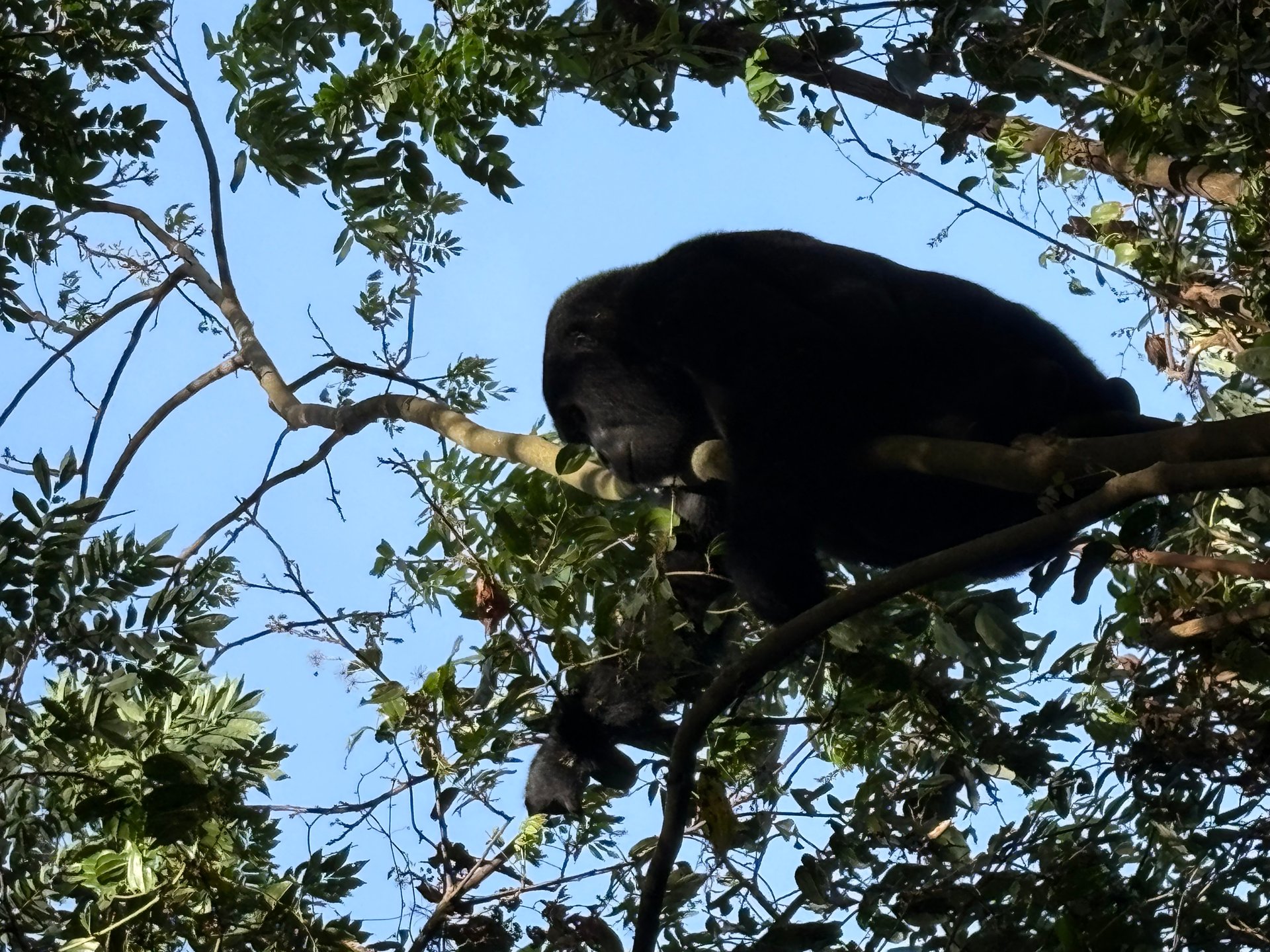
A fairly large gorilla sits in a tree above us, breaking a branch and pressing it to his mouth. He has been doing this for several minutes. He does not look down. On 21 January 2026, at GPS coordinates -0.9735°N, 29.6281°E inside Bwindi Impenetrable National Park, I stood a few metres below and watched him eat. The photograph at the top of this page captures something almost impossible to convey in advance: how close the bwindi gorillas allow you to come, and how completely indifferent they are to your presence once they have been habituated to human observers.
It took roughly one hour of walking from the Buhoma sector trailhead before our guide called a quiet halt and pointed upward through the canopy. The first gorilla of the day was already at height, working methodically through the foliage with both hands, eating with the focused efficiency of an animal that spends much of its day acquiring calories. Below him, younger family members moved through the undergrowth. We stood without speaking for a long time.
This guide is drawn from that January 2026 visit and a return in June 2026. It covers what the trek is actually like from the trailhead to the encounter and back, what to pack for the mountain terrain, where to stay in the Buhoma area, and the conservation challenges — including illegal wildlife trade — that give the permit fee its meaning beyond the experience itself.
What a Gorilla Trek in Bwindi Actually Looks Like
The trailhead for the Buhoma sector sits at the northern edge of the village, a short walk from the Uganda Wildlife Authority sector office. Our group — six visitors plus a guide and two rangers — was briefed there before setting out at around eight in the morning. The UWA officer confirmed that no one was showing respiratory symptoms (gorillas share roughly 98 per cent of human DNA and are highly susceptible to our illnesses), checked that no one had strong food odours, and reviewed the seven-metre rule and the absolute prohibition on flash photography. Then we walked into the forest.
The first section of trail is deceptively ordinary. It climbs through the outer agricultural zone — terraced plots of beans, cassava, and plantain that press right up against the park boundary — before the canopy closes overhead and the character of the walk changes completely. Temperature drops. The quality of light changes. Sound that was background noise — birds, insects, wind through banana leaves — becomes foreground. Underfoot, the red laterite gives way to loose roots and wet clay.
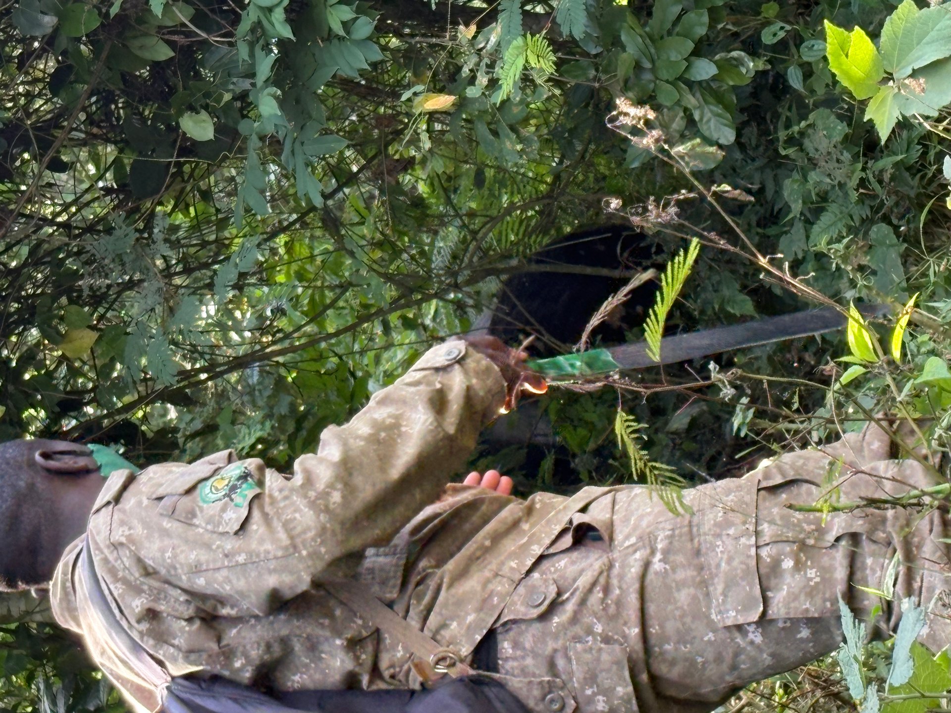
The rangers moved without urgency. They were in contact by radio with trackers who had entered the forest at dawn to locate where the habituated family had nested overnight. Gorillas build fresh sleeping nests each evening — on the ground, in low vegetation, or occasionally in tree forks — and the trackers follow the trail from the previous day's last recorded position. By the time trekkers enter the forest, the hard work of location has usually already been done.
What struck me about the rangers during the walk was their dual role. They were security personnel — each carried a rifle, which felt unusual at first but was unremarkable within minutes — and they were also the most capable members of the group on difficult terrain. When the trail became a near-vertical scramble through wet root systems, the rangers produced stout walking sticks cut from saplings and positioned themselves at the worst sections to offer a steadying arm without being asked. Their knowledge of the forest was total: the name of every tree, which fruit each species produced, which birds used which layer of the canopy.
After approximately one hour, the lead ranger stopped, crouched, and pointed up through a gap in the canopy. The silverback was in the tree before we had properly adjusted our eyes to the shade. He was large — visibly heavy even at height — working through the foliage with both hands and eating with the focused efficiency of an animal that spends most of its day acquiring calories. Below him, younger family members moved in and out of the undergrowth. The encounter was impressively calm. He ate in the tree, completely indifferent to the small group of humans standing beneath him.
Uganda Wildlife Authority regulations cap visits at exactly one hour once the gorillas are located. The time limit is calibrated to the evidence on how sustained human presence elevates gorilla stress hormones — a threshold that appears in the guidelines of the International Gorilla Conservation Programme and informs UWA policy. When our guide signalled the end of the hour, nobody argued. The encounter had been complete in the only sense that matters.
What to Pack for Gorilla Trekking in Bwindi
The Buhoma sector sits above 1,600 metres. In January the mornings are cool — damp from overnight mist — and the undergrowth is wet throughout the first hour of the trek. By mid-morning, the climb generates enough body heat to make a heavy jacket uncomfortable. Packing for that range — cold and wet at dawn, then warm and physical by nine — is the central challenge, and the usual mistake is to bring too much rather than too little.
Clothing
Long trousers and a long-sleeved shirt are mandatory — not a dress code but a practical necessity. The undergrowth is dense and frequently thorny, and rangers will ask the group to push through vegetation rather than wait for it to be fully cleared. Choose subdued colours: olive, khaki, dark green, or brown. Avoid blue; research on gorilla behaviour identifies it as a threat-associated colour. Avoid bright red, white, or any high-contrast pattern. Do not wear camouflage — that is reserved for ranger uniforms and creates confusion in the field context.
Boots matter more than almost any other item. Trail surfaces shift unpredictably between loose laterite, wet roots, and slippery grass. Ankle support is essential; trail runners without ankle coverage are a genuine injury risk on steep descents. Waterproofing keeps the feet dry for the first hour or two; after that, wet undergrowth finds every gap regardless, so carry a dry pair of socks in a zip-lock bag for the return journey.
Thin gardening gloves are listed in every Uganda trekking guide and are genuinely useful — not for warmth but for gripping vegetation when the slope demands it. Thick rubber gloves are cumbersome. A lightweight rain jacket packs into a fist-sized roll and serves equally as a windbreak at altitude on dry mornings.
Equipment
Carry at least two litres of water and a supply of high-energy snacks — nuts, dried fruit, an energy bar. The forest offers no resupply points; guides and rangers work through the morning without stopping. A 20–25 litre daypack is the right size: large enough for the day's kit, small enough to avoid catching on vegetation. Keep the camera accessible near the top, accessible without noise — fumbling with a zip at the critical moment is a reliable source of regret.
Camera settings need to be sorted before you enter the forest. Disable flash completely — this is a UWA regulation enforced in the field, not merely a guideline. Set ISO to 800 or above: under a closed canopy at eight in the morning, a gorilla at ten metres is lit primarily by reflected light. A fast lens is more useful than optical zoom; mountain gorillas at seven metres require focal length, not telephoto. Image stabilisation matters significantly on a hand-held camera after an hour of uphill walking.
Leave trekking poles at the lodge unless they are medically necessary. In dense undergrowth, a rigid pole in your hand is a hazard for the person behind you, and it prevents you from using both hands on steep sections. The rangers' cut-stick method is more practical in this specific terrain.
Where to Stay Near the Bwindi Gorillas
Bwindi Impenetrable National Park in Uganda has four gorilla trekking sectors: Buhoma, Ruhija, Rushaga, and Nkuringo. Each sector has its own habituated families, its own trailhead, and its own permit allocation. Choosing a lodge and booking a permit are a linked decision — once the permit specifies a sector and date, there is no inter-sector transfer.
Gorilla Bluff Lodge, Buhoma
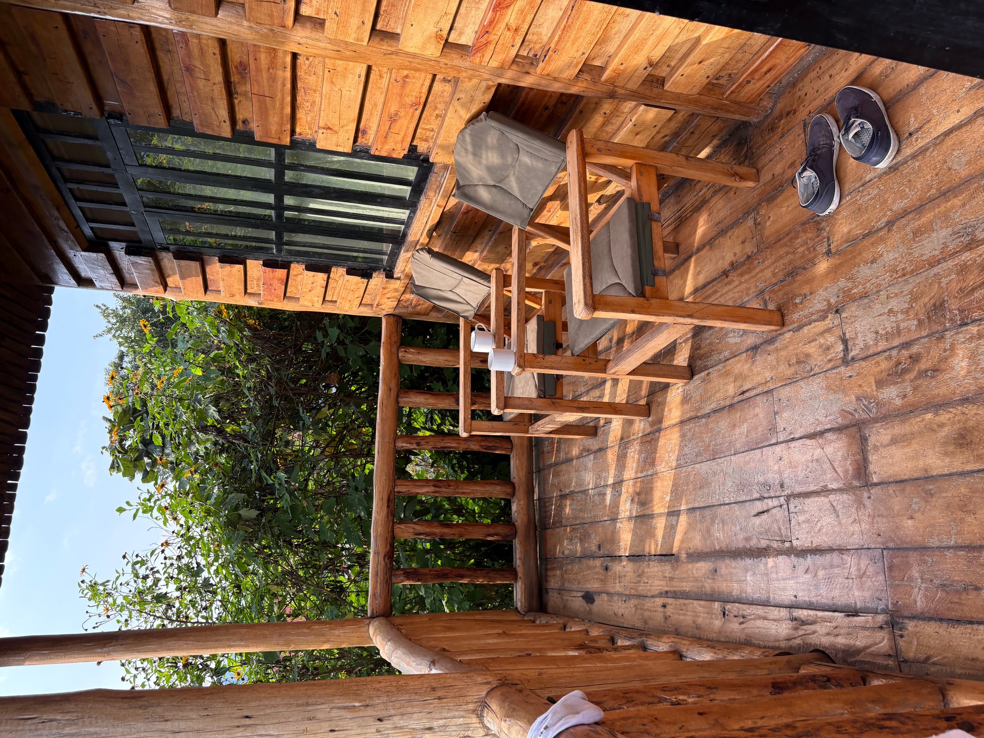
We stayed at Gorilla Bluff Lodge during the January 2026 visit. Each room has a private wooden terrace with a direct line of sight into the forest canopy; every morning, the lodge brought coffee and African tea before the trek briefing — a ritual that proved useful for calibrating clothing layers against the early-morning chill. The lodge sits on the hillside above the village, within walking distance of the Buhoma trailhead. The return from a long trek arrives at the terrace on a manageable uphill rather than a steep final climb. Directly opposite the lodge on the road, a small informal market of young artists sells hand-painted gorilla and forest scenes — a quick stop on the way back from the trek is worth the ten minutes.
Ruhija Gorilla Safari Lodge
The Ruhija sector sits at higher elevation than Buhoma — cooler, wetter, with a different bird assemblage in the upper-altitude forest. Ruhija Gorilla Safari Lodge, operated by Asyanut Safaris, offers double rooms and wooden cottages close to the sector departure point. The families habituated to the Ruhija sector include some of the larger groups in Bwindi, and the higher canopy supports species — including several Albertine Rift endemics — that do not appear at Buhoma. For travellers combining gorilla trekking with serious birding, Ruhija is a more productive base.
Nkuringo Bwindi Gorilla Lodge
Nkuringo sits at 2,090 metres on the southern edge of Bwindi and operates eighteen rooms, making it one of the larger properties in the park's accommodation circuit. The lodge has established a carbon-offset partnership with the Uganda Carbon Bureau, allowing guests to calculate and offset the emissions from their travel to and from the park — an option that addresses the increasingly common question of how to account for the environmental cost of a long-haul flight to see gorillas. The Nkuringo sector also offers a habituation experience permit that allows a half-day with researchers and a family still in the habituation process, for travellers who want a more extended and less choreographed encounter than the standard one-hour visit.
The Conservation Work Behind the Encounter
The 459 mountain gorillas recorded in Uganda during the 2018–2020 population assessment represent roughly half the global total for the subspecies Gorilla beringei beringei. The other half lives in the Virunga massif, spread across Rwanda, Democratic Republic of Congo, and Uganda. The combined global count of just over 1,000 individuals places this subspecies among the most critically endangered large mammals on Earth — but the number itself represents a recovery: the combined population was estimated at approximately 620 individuals in 2010. That improvement is the result of sustained, multi-decade conservation investment, not natural population dynamics.
The revenue from gorilla trekking permits funds a significant share of that infrastructure. Uganda Wildlife Authority allocates a percentage of park gate receipts to the ranger force, community revenue-sharing programmes, and habitat management. The exact proportions are governed by the Uganda Wildlife Regulations 2022. The US$800 permit is, among other things, a contribution to the patrol capacity that keeps the Bwindi forest intact.
Illegal Wildlife Trade: The Broader Threat
Illegal wildlife trade is a persistent and under-addressed threat across Uganda's protected areas. Gorillas are rarely the direct targets — their size, social cohesion, and the international visibility of their conservation status make them impractical to exploit commercially. But they share the Bwindi forest with species that face severe poaching pressure. Pangolins are among the most trafficked mammals in East Africa; their scales, exported primarily to Asian traditional medicine markets, command prices that make poaching economically rational in low-income contexts. African grey parrots, whose range includes forests in western Uganda, are captured for the live bird trade. Both species are protected under CITES Appendix I, making commercial trade internationally illegal — a designation that has not eliminated demand.
The Uganda Wildlife Authority works with a set of partner organisations on interdiction and prevention. The African Wildlife Foundation, which has operated in the Bwindi landscape for decades, supports community ranger programmes and provides technical assistance on snare removal and patrol methodology. The Uganda Cleaner Production Centre runs training programmes addressing the economic drivers of poaching by strengthening legal livelihood alternatives — recognising that enforcement alone, without viable income options, does not reliably reduce the incentive to poach.
The connection between a gorilla trekking permit and pangolin protection is indirect but real. The ranger force that patrols the forest for gorilla welfare is the same force that removes snares targeting smaller mammals. Conservation in Bwindi is not organised by species; the protection systems are landscape-wide. When you pay for a gorilla permit, you fund the patrol infrastructure that every species in that forest depends on.
Reaching Bwindi: The Road from Kampala
The overland route from Kampala to Buhoma runs south-west through Masaka and Mbarara, then turns south toward Kabale and north-west along the escarpment to Bwindi. The distance is approximately 530 kilometres and the drive, given road conditions, takes between seven and ten hours. Most travellers break the journey with an overnight stop in Fort Portal, Mbarara, or Kabale.
I drove the Masaka Highway section in January 2026 and it was mid-construction: long stretches of red laterite and dense dust, heavy lorries queuing in both directions, boda-bodas threading between stationary vehicles. The noise and delay were considerable. The new tarmac sections already visible gave a clear sense of what the road will become — wider, properly drained, significantly faster — once the work is finished. Uganda's government road construction budget for FY 2024/25 included approved funding of over 121 billion Uganda Shillings for roads and bridge improvements (Budget Output 260007, Ministry of Works), with additional external financing for road rehabilitation. The Masaka Highway is one visible result.
For travellers with limited time, scheduled charter flights connect Entebbe to Kihihi airstrip (near Ishasha) and to Kisoro for the southern Bwindi sectors. The road journey rewards patience: the Rift Valley escarpment west of Mbarara, the Kigezi highlands dropping toward Kabale, and the abrupt transition from open hillside to the enclosed green wall of Bwindi's forest edge are among the most striking landscape sequences in the country.