The First Encounter: A Gorilla in the Canopy
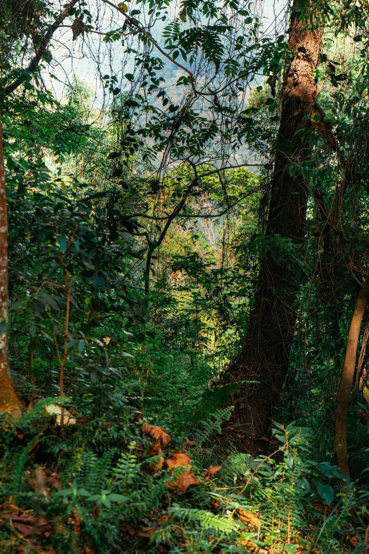
During our gorilla trek in January 2026, roughly an hour into the walk, our guide stopped and pointed upward. There, settled into the fork of a large tree, sat a substantial gorilla — calm, unhurried, working through a branch of fresh leaves as though the small group of humans below barely registered. The moment was extraordinary precisely because of what surrounded the animal: a dense tangle of branches, filtered light, hanging vegetation, and the particular smell of deep forest. The gorilla was not just in the forest; it was inseparable from it.
That image — a large primate feeding quietly in the mid-canopy, entirely at ease — captures something that no species count or vegetation survey fully conveys. The forest is not a backdrop for the gorillas. It is the substrate of their existence. Every metre of that layered, species-rich vegetation is the product of ecological processes that took millennia to develop and that the gorillas depend on completely. Understanding what makes Bwindi's vegetation work for gorillas is therefore not an academic exercise — it is the foundation of any serious conservation effort here.
I visited Bwindi across multiple stays, including eight days in October 2024 and further time in January 2026. Those days in the field, with GPS-documented positions in the forest, informed everything that follows. This is not a desk-based summary of someone else's research; it is an attempt to explain what the science says in light of what the forest actually feels like from inside it.
Forest Structure: What “Impenetrable” Actually Means
Bwindi Impenetrable National Park covers approximately 331 square kilometres of afromontane forest in southwestern Uganda, at elevations ranging from roughly 1,160 to 2,607 metres above sea level. The name “impenetrable” is not metaphor — it describes a forest with so many overlapping layers of vegetation that movement without a machete is genuinely difficult in much of the interior. Rangers on our trek used machetes at several points to clear a path through dense understorey growth, and even the established trails required careful navigation through roots, vines, and fallen branches.
In ecological terms, Bwindi qualifies as a Tropical High Forest — classified under Uganda's national biodiversity framework as Riverine Forest, the most biodiverse forest type assessed in the country's ecosystem metrics system. This classification carries specific structural expectations: a canopy of tall emergent trees, a closed mid-storey, a shrub layer, and a ground layer of herbs and ferns. The Tropical High Forest category is assigned seven distinct condition attributes in the biodiversity metrics framework, more than any other non-wetland ecosystem type, which reflects the ecological complexity involved.
For gorillas, that structural complexity is not just interesting — it is necessary. A family group moves through different vertical layers of the forest at different times: feeding at ground level on herbaceous plants and roots in the morning, climbing into the lower to mid canopy for leaves and fruit during the day, and constructing night nests on the forest floor or in shrubs. The forest must provide resources at each of those levels consistently across the seasons.
Biodiversity Metrics and What They Measure
The challenge of assessing habitat quality for conservation purposes is converting complex ecological reality into numbers that can be measured repeatedly in the field. Uganda has developed a national biodiversity metrics system that does exactly this: it defines, for each major ecosystem type, a set of field attributes that reliably reflect overall ecosystem condition, along with benchmark values derived from measurements in high-quality reference patches of each ecosystem.
For forests like Bwindi, the key metrics include tree species richness within a 20-metre radius — a measure of how many different tree species are present in a given area. This single figure is one of the most informative indicators of forest condition because it captures both habitat complexity and food-plant diversity. A 20-metre plot in a degraded, disturbed forest might contain three or four tree species; the same plot in an intact area of Bwindi can yield significantly more. A second core metric measures overall species richness within a 5-metre radius, capturing the diversity of the shrub and herb layers where much gorilla ground-feeding occurs.
These metrics combine into a condition score that, when multiplied by the area of forest assessed, produces a “quality-hectares” figure. This framework is deliberately designed so that both area and condition matter: a small patch of excellent-condition forest and a large patch of degraded forest can yield the same score, which captures the real conservation trade-off that managers face. For gorilla habitat specifically, condition matters enormously because the animals cannot compensate for poor food-plant diversity by simply ranging further — their social structure and territorial behaviour impose limits on how far a family group moves.
One important caveat built into the metrics framework: attributes are somewhat tradeable. A patch that scores high on canopy height but low on shrub cover may receive a similar total score to a patch that scores moderately on both. This means raw condition scores require interpretation by people familiar with the specific habitat needs of the species in question. For mountain gorillas, shrub and herb layer diversity is particularly important because it determines ground-level food availability; a forest that scores well on canopy metrics but has a depleted understorey may be less suitable for gorillas than the aggregate score suggests.
Plant Diversity, Endemism, and the Gorilla Food Web
Bwindi's position at the junction of the Albertine Rift and the Congo Basin forests makes it one of the most botanically diverse areas in Africa. The park contains more than 1,000 flowering plant species, including a disproportionate number of endemics — plants found nowhere else on Earth. Among these is Rotheca violacea subsp. kigeziensis, a plant assessed as Critically Endangered on the global IUCN Red List and endemic to Kibale Forest and the area around Mulole Hill near Bwindi. Its presence in the landscape is a signal of the broader rarity and irreplaceability of the vegetation communities here.
Mountain gorillas are remarkably flexible feeders, consuming more than 100 plant species in Bwindi alone. Their diet shifts with altitude, season, and the structure of the vegetation in their current ranging area. At lower elevations, family groups tend to consume more fruit when it is available; at higher elevations, where fruiting trees are less common, they rely more heavily on leaves, stems, bark, and roots. This dietary flexibility is itself a product of the forest's botanical diversity: a species-poor forest simply cannot support that range of food options across all altitudes and seasons.
Bamboo is another critical component of the habitat, particularly during the bamboo shooting season when young shoots emerge rapidly and gorillas travel specifically to exploit them. Bwindi contains significant bamboo zones, and family groups may range further than usual during the shooting period. This makes bamboo zones a conservation priority within the park — which is one reason why bamboo collection by people extracting forest products is particularly damaging.
[QUOTE: local guide on which plant zones gorilla families return to most reliably]
Threats to Vegetation Integrity Inside the Park
Bwindi is formally protected, but protection does not mean the vegetation is static or unthreatened. Ranger patrol data recorded between 2020 and 2025 showed between 20 and 60 incidents of non-timber forest product extraction per year inside park boundaries. These incidents include bamboo collection, firewood cutting, harvesting of medicinal plants, and illegal cultivation at park margins. Individually, each incident removes a small quantity of biomass. Collectively, across years and across the park, the cumulative effect is a measurable suppression of vegetation in accessible areas close to community boundaries.
The distribution of this pressure is not random. Extraction incidents cluster near the forest edge and along paths that people have used historically. This means the vegetation degradation they cause is also spatially concentrated, creating a gradient of habitat quality from the park interior (higher quality) toward the boundary (lower quality). For gorilla families whose home ranges include boundary zones, this gradient translates into reduced food availability in the areas where human–wildlife conflict risk is already highest.
Wildlife corridor integrity also matters. Elephant and chimpanzee corridors connecting Budongo and Bugoma forests to Kibale, and linking Kibale to Bwindi, have been disrupted by infrastructure development associated with tourism expansion. While Bwindi's gorillas do not use these corridors directly, the broader landscape context matters: Bwindi is an island of forest in a heavily farmed landscape, and the genetic and ecological connectivity that corridors provide supports the long-term health of the entire Albertine Rift forest system.
The 16-kilometre stone wall maintained by Uganda Wildlife Authority at the adjacent Mgahinga Gorilla National Park illustrates the scale of effort required to manage the boundary between gorilla habitat and farmland. While this infrastructure addresses crop raiding rather than vegetation extraction, it reflects the broader reality that protecting gorilla habitat in the Ugandan highlands means actively managing a contested boundary between a small, isolated forest and a densely settled agricultural landscape.
Vegetation, Biodiversity, and the Resilience Argument
There is a case for protecting Bwindi's vegetation that goes beyond the gorillas themselves, though it ultimately circles back to them. Forest biodiversity — the number and variety of plant and animal species in a system — is a primary driver of ecosystem resilience. A species-rich forest can draw on a wider range of adaptive responses when conditions shift. If one food-plant species is stressed by drought or changed rainfall patterns, another may thrive in those same conditions. The gorillas' dietary flexibility is, in a sense, an expression of this principle at the consumer level: they can shift between food sources when one is unavailable precisely because the forest offers alternatives.
Bwindi and the neighbouring Echuya Forest Reserve also shelter what is described in current wildlife assessments as the stronghold for one of Uganda's most threatened cat species — a rarity within a rarity, present in only two protected areas in the country. The gorillas are the headline species, but the vegetation that supports them also supports a much wider community of endemic and threatened organisms. Conserving the vegetation structure means conserving all of it.
What that means practically is that gorilla conservation and vegetation conservation are not separate programmes. Every intervention that maintains canopy cover, reduces forest-edge extraction pressure, and preserves the understorey diversity in Bwindi is simultaneously a gorilla conservation intervention. And every gorilla conservation programme that brings revenue into the communities surrounding Bwindi — through responsible tourism — creates an economic rationale for those communities to support forest protection. The vegetation, the gorillas, and the people who live alongside the forest are bound together in a system that either works as a whole or fails in parts.
The gorilla sitting in that tree in January 2026, feeding on leaves in the filtered light of a forest that has existed in some form for millions of years, was not just a wildlife spectacle. It was evidence that the system was, at least in that moment, still working.