
A Legal Architecture Built on Spatial Boundaries
Uganda's approach to nature conservation rests on a system of legally defined spatial categories — territories where land use is restricted, controlled, or entirely prohibited in order to protect biodiversity, watersheds, and wildlife. These categories range from national parks, where the strictest protections apply, through wildlife reserves and game management areas, to central forest reserves managed under a separate authority. Understanding how these categories differ, how they come into being, and who manages them is essential context for anyone seeking to understand how Bwindi Impenetrable National Park fits into Uganda's wider conservation landscape.
The system is not purely ecological. It is administrative and legal, which means its effectiveness depends as much on enforcement, boundary demarcation, and governance capacity as on the biological value of the land it covers. Areas that are gazetted on paper but never properly demarcated on the ground, or where management authority is contested between different agencies, present real conservation challenges regardless of their legal status.
During multiple visits to Bwindi and the surrounding region — including stays in October 2024 and January 2026 — the practical consequences of these legal distinctions became apparent in the field. The line between a national park and the farmland pressing against it is not an abstraction. It is a physical edge that rangers patrol, that communities negotiate over, and that gorillas cross without regard for the legal status of the land on either side.
National Parks: Uganda's Highest Protection Category
Uganda currently has ten gazetted national parks. These include Bwindi Impenetrable National Park, Queen Elizabeth National Park, Murchison Falls National Park, Kibale National Park, and several others spread across the country's major ecological zones. Each was formally established through a legal instrument published in the Uganda Gazette, a process that defines the park's boundaries, determines the managing authority, and sets the legal framework under which land use inside is governed.
Under the Uganda Wildlife Act 2000 and its subsequent amendments, national parks are the most strictly protected land category available. Cultivation, livestock grazing, permanent settlement, logging, and mining are all prohibited inside their boundaries. The only authorised human activities are wildlife management, conservation-related research, and tourism as permitted by Uganda Wildlife Authority. Penalties for violations are substantial, and UWA rangers have legal authority to arrest offenders within park boundaries.
Bwindi Impenetrable National Park was first gazetted as a forest reserve, then as a game sanctuary, before receiving full national park status in 1991. This history matters because it means the park has undergone multiple legal transitions, each of which required adjustments to boundaries, management arrangements, and relationships with surrounding communities. The park was also inscribed as a UNESCO World Heritage Site in 1994, adding an international layer of protection and scrutiny to its management.
[QUOTE: local guide on first impressions of the park boundary near Buhoma]
Wildlife Reserves and Forest Reserves: Differentiated Management
Below national parks in the protection hierarchy, Uganda maintains twelve wildlife reserves managed by Uganda Wildlife Authority. These areas offer significant biodiversity value and legal protection, but they permit a wider range of human activities than national parks do. Regulated livestock grazing, controlled fishing, and in some cases limited cultivation are possible in designated zones within wildlife reserves, subject to permits and management agreements. The Semliki Wildlife Reserve in western Uganda, covering approximately 548 square kilometres along the Albertine Rift, is one example: established through colonial-era conservation measures as early as 1913, it has experienced cycles of degradation and recovery, and today it allows certain pastoral uses while protecting a remarkable assemblage of Central African lowland species found nowhere else in Uganda.
Uganda's central forest reserves present a third management model. Numbering over 700, these areas fall under the National Forestry Authority rather than Uganda Wildlife Authority. Their primary legal basis is watershed protection, soil conservation, and sustainable timber production. Some central forest reserves contain high biodiversity value — Maramagambo Central Forest Reserve, which borders Queen Elizabeth National Park and contains the well-known Python Cave, is one notable example — but their management framework is oriented differently than national parks. Extractive uses are permitted under licence, and the boundary between conservation and production forestry is managed through annual allowable cut calculations and compliance monitoring rather than outright prohibition.
This institutional division between UWA and the National Forestry Authority occasionally creates coordination challenges at the landscape level. Bwindi, for example, is ecologically connected to the Echuya Central Forest Reserve to the south, managed by the National Forestry Authority. The connectivity corridor between Bwindi and Echuya matters for primate populations that range across both areas, but the two areas fall under different legal frameworks and different management mandates.
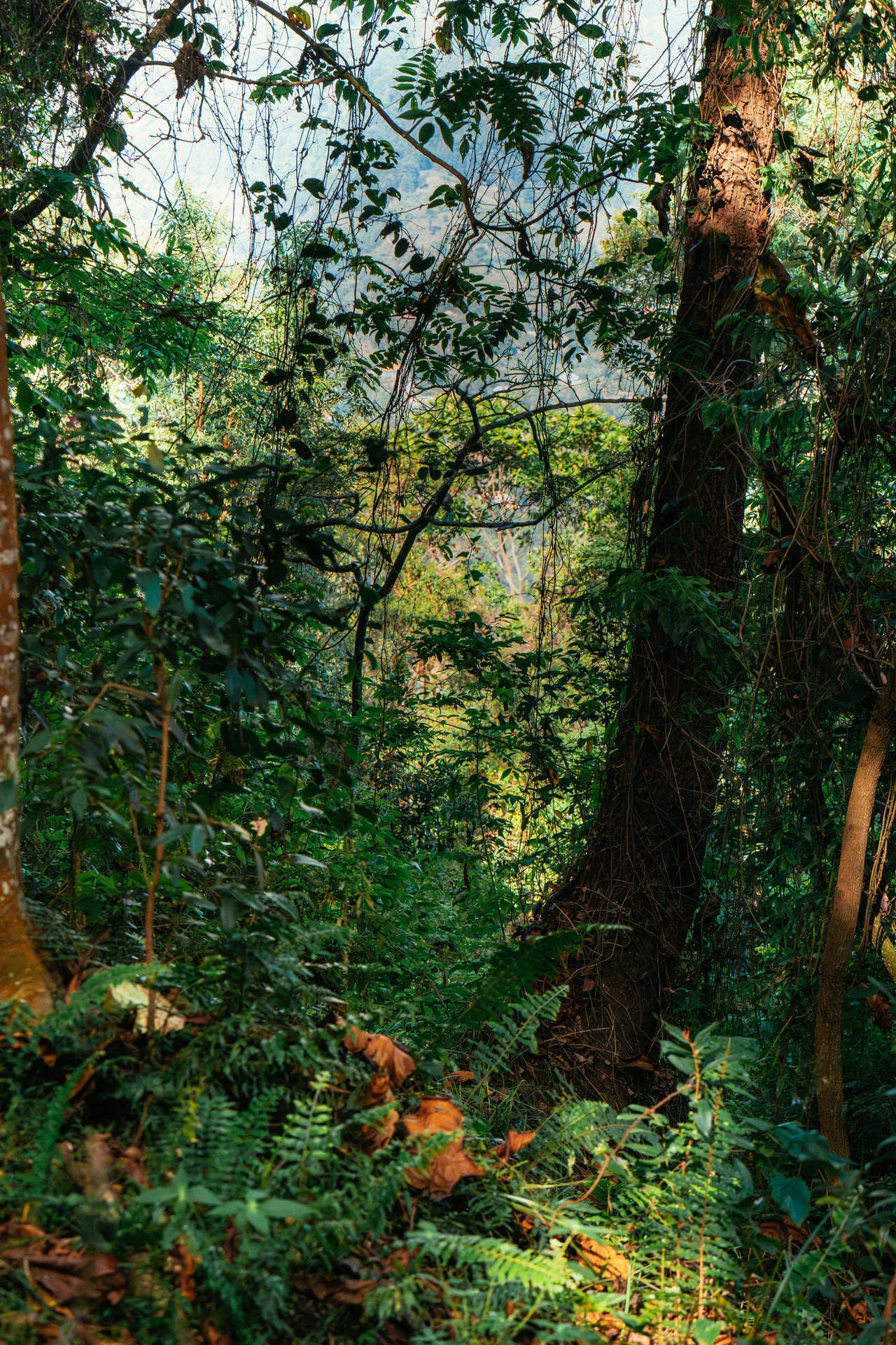
Dense jungle at the start of the gorilla trekking trail

Gorilla trekking in Bwindi: the path through the rainforest

Through Bwindi forest on the trail of gorillas
Gazettement: How Protected Areas Become Law
Gazettement is the mechanism by which a parcel of land moves from ordinary administrative status into a legally defined protected category. The process involves preparing a statutory instrument that describes the area by coordinates or reference to established survey points, designating the managing authority, and publishing the instrument in the Uganda Gazette. Once gazetted, the designation has the force of law and cannot be reversed without a new legislative or regulatory act.
The practical challenge with gazettement is that publishing a boundary in the Gazette does not automatically mark it on the ground. Many of Uganda's protected areas have legally valid gazette notices that pre-date modern GPS surveying, meaning that the described boundary may be ambiguous or inconsistent with the actual landscape. Where no physical markers exist on the ground, communities adjacent to a protected area may genuinely be unaware of exactly where the legal boundary falls, and park rangers may have difficulty demonstrating that a particular activity is occurring inside rather than outside the protected zone.
This gap between legal and physical boundaries is one of the most persistent operational challenges for protected area management in Uganda. At Bwindi, the General Management Plan explicitly identifies unclear boundary demarcation in the Mbwa Tract and Bujengwe as Management Challenge number six, and outlines a series of actions designed to resolve it. The resolution requires both physical demarcation — planting live boundary markers, installing permanent survey posts — and legal process, including formal agreements with adjacent community groups and in some cases adjustments to the gazetted boundary description itself.
For areas with significant wildlife populations including African elephants, the precision of gazetted boundaries directly affects how wildlife movements outside the park are legally classified and how UWA can respond to conflicts. An elephant that moves into farmland outside a clearly gazetted and demarcated boundary poses a different set of legal and practical questions than one that strays across an unmarked and disputed line.
Uganda Wildlife Authority: Mandate, Structure, and Spatial Planning
Uganda Wildlife Authority was established under the Uganda Wildlife Act 2000 as a semi-autonomous government agency responsible for the management of national parks and wildlife reserves. Its board reports to the Minister responsible for wildlife, and its mandate spans law enforcement, revenue generation from tourism, community conservation, research support, and international wildlife treaty obligations. UWA is the Ugandan institution that issues gorilla trekking permits, manages ranger deployment, and develops the General Management Plans that govern each protected area.
The spatial dimension of UWA's mandate is expressed most concretely in its General Management Plans. These documents, produced for each national park on a roughly ten-year cycle, define management zones within the park, set population targets for key species, establish patrol strategies, determine where tourism infrastructure is permitted, and outline the programme of boundary management actions. The Bwindi GMP 2014–2023 runs to several hundred pages and addresses everything from gorilla health protocols to anti-poaching intelligence systems and community benefit-sharing structures.
Uganda's protected areas are not managed in isolation. At the national level, UWA coordinates with the National Environment Management Authority, which is responsible for environmental impact assessments and enforcement of environmental regulations across all land categories, including the Environmental Protection Areas designated under the National Environment Act. These Environmental Protection Areas can overlap with or extend beyond formally gazetted wildlife areas, creating additional regulatory layers in ecologically sensitive zones.
The broader context of spatial planning in Uganda also includes the challenges posed by resource extraction. The Lake Albert region in the northwest, where petroleum reserves have been identified, lies within and adjacent to wildlife reserves. The Semliki Wildlife Reserve faces pressure from oil sector development that has been planned in its vicinity for over a decade. Balancing resource extraction with the legal protections afforded by wildlife reserve status is an active policy question, and one that illustrates why the legal architecture of protected areas matters far beyond the boundaries of the parks themselves.
Environmental Protection Through Spatial Planning
The designation of protected areas in Uganda can be understood as a form of spatial planning: an exercise in determining which land uses are permitted where, and encoding those decisions in law. This framing connects the conservation system to broader questions of environmental governance, urban planning, and natural resource management that affect the entire country, not only the forested areas where national parks are concentrated.
Greater Kampala, as Uganda's largest urban area, has its own integrated urban development planning documents that include environmental protection area designations. Wetlands, riparian corridors, and urban green spaces are spatially protected through zoning mechanisms analogous to those used for national parks, though the implementing authority and enforcement regime differ substantially. The principle — that certain areas are legally designated for environmental protection and that this designation restricts permissible land uses — operates across scales from the national park to the urban drainage basin.
For Bwindi and for Uganda's other national parks, this wider context matters because it determines the institutional partners UWA must engage when conservation interests intersect with development. A road that approaches the park boundary, a settlement that grows toward the forest edge, or an oil pipeline proposed in a wildlife corridor all require navigation of overlapping legal frameworks. Protected area management in Uganda is, in this sense, inseparable from national environmental governance.
Across multiple visits to the region from October 2024 through May 2026, the evidence of this intersection is visible on the ground. The villages adjacent to Bwindi have grown. The road network connecting them to regional centres has improved. Market access has increased, bringing both economic opportunity and intensified pressure on forest-edge land. The legal framework of protected areas is what stands between that pressure and the forest — not as an abstract line on a map, but as a set of actively enforced, constantly renegotiated constraints that determine whether Bwindi's 331 square kilometres remain intact a generation from now.