Uganda's Forest Protection Framework
The bwindi impenetrable forest national park uganda is the most celebrated forest in the country, home to roughly half the world's remaining mountain gorillas and a UNESCO World Heritage Site since 1994. But Bwindi does not stand alone. It is the most prominent node in a national network of protected forests that stretches across Uganda's 241 districts — a network built on two parallel systems: national parks managed by the Uganda Wildlife Authority, and Central Forest Reserves (CFRs) managed by the National Forestry Authority. Understanding how CFRs work, and how they connect to Bwindi, is essential to understanding Uganda's broader approach to forest conservation.
The National Forestry Authority administers more than 500 gazetted CFRs across Uganda, covering forests that range from highland cloud forests in the west to savanna woodlands in the north and east. Their legal basis is the National Forestry and Tree Planting Act of 2003, which formally separated forest management from wildlife management and established the NFA as the dedicated agency for non-park forest estate. Within a CFR, activities such as prospecting, settlement, and clearing are prohibited without a formal licence. The NFA may permit controlled timber harvesting, community use of non-timber forest products, and ecotourism under specific management agreements, but the default status of a gazetted CFR is protected.
The Alebtong Case: Five Reserves Under Pressure
Alebtong District in northern Uganda contains five Central Forest Reserves: Aloi, Okurango, Abunga, Epor, and Adero. Together they cover approximately 1,174 hectares — a modest total that is nonetheless significant for a district where population density in some sub-counties exceeds 300 people per square kilometre. The 2024 National Population and Housing Census recorded a total population of over 283,000 across Alebtong's nine sub-counties, concentrated into a land area of roughly 1,534 square kilometres.
This demographic pressure is the central fact of forest management in Alebtong. When agricultural land is scarce and alternative livelihoods limited, the forest boundary represents a temptation. All five reserves in the district have been documented as experiencing illegal encroachment and resource extraction by neighbouring communities. The pattern is familiar across Uganda's CFR network: gradual clearing of boundary areas for cultivation, charcoal burning of standing trees, and seasonal grazing of livestock inside reserve boundaries. Each incursion is individually small; cumulatively, they degrade the reserve's ecological function and reduce the area of effective forest cover.
[QUOTE: local guide on first impressions of Alebtong reserves]
Management Profiles: Aloi, Okurango, Abunga, Epor, Adero
Each of the five Alebtong reserves has a distinct character and position within the landscape. Aloi Forest Reserve sits near Aloi Town Council, one of the district's more urbanised centres, which creates particular pressure from peri-urban expansion and charcoal demand. Okurango and Abunga are more rural in their setting, with predominantly agricultural communities along their boundaries. Epor and Adero are smaller reserves where the gap between gazetted area and actively forested area has been widening as encroachment advances.
The district's development plan for 2025 to 2030 acknowledges the environmental situation directly. In the preceding five-year period, the district planted four hectares of trees across Omoro, Abako, Aloi, and Awei sub-counties, trained two community groups and 27 local environment committee members on nursery establishment, and held commemoration events for World Environment Day at which the district, IUCN, and NFA distributed seedlings for community planting. Four demonstration nursery sites were established in Amugu, Aloi, and Apala sub-counties, and 150 community members received training. A further 400 people were trained on climate change and wetland use across seven sub-counties.
These are meaningful interventions, but the district's own planning documents are candid about the limiting factor: inadequate funding. The plan describes insufficient resources as a cross-cutting problem that undermines service delivery across all sectors, including environment and natural resources. This constraint is not unique to Alebtong — it echoes the experience of forest management districts across Uganda.
How CFRs Connect to the Bwindi Conservation System
The relationship between CFRs like those in Alebtong and a flagship protected area like bwindi impenetrable forest national park uganda is not a direct geographical one — the two are separated by several hundred kilometres. The connection is systemic. Both fall under Uganda's national forest protection framework. Both depend on NFA enforcement capacity, community engagement, and consistent government investment to maintain their ecological integrity. When the CFR network functions well, it reduces the pressure on primary forests by providing sustainable yields of timber and non-timber products closer to where communities live. When CFRs degrade, that pressure migrates toward larger, more remote forests.
The landscape around Bwindi illustrates this dynamic clearly. The forests immediately bordering Bwindi include several CFRs that serve as buffer zones, absorbing resource demand from communities that might otherwise look to the national park itself. In the southwest, CFRs in Kanungu and Rukungiri districts form part of the wider Greater Virunga Landscape, a transboundary conservation area that connects Bwindi to Mgahinga Gorilla National Park in Uganda and to protected areas in the Democratic Republic of Congo and Rwanda. The health of these smaller reserves directly affects the connectivity available to mountain gorilla families ranging across the landscape.
During stays at Bwindi totalling more than 24 days across multiple visits between October 2024 and June 2026, the pattern of community-forest interaction was consistently visible along the park's boundaries. Farms press close to the forest edge. The boundary is not an invisible line — it is a zone of active negotiation between conservation and subsistence. Understanding that dynamic at Bwindi makes the situation in Alebtong's reserves immediately legible. The pressures are the same; the scale and ecological stakes differ.
The National Forestry Authority's Role
The NFA is responsible for the management of Uganda's permanent forest estate, which includes all CFRs as well as forest reserves on private land. Its mandate covers boundary demarcation and maintenance, licensing of forest use, enforcement against illegal activities, research and monitoring, and community outreach. The authority operates through a network of district forest offices whose staff conduct patrols, investigate encroachment cases, and liaise with local governments.
In practice, the effectiveness of NFA management varies considerably between reserves and districts. High-profile reserves near tourism infrastructure or in areas with strong civil society presence tend to receive more consistent attention. Smaller reserves in remote or underfunded districts face longer periods between management interventions. For reserves like those in Alebtong, the challenge is not a lack of legal tools but a lack of the resources needed to deploy them consistently and at the scale the situation requires.
Community-Based Conservation as a Complement
The limitations of top-down enforcement have pushed forest managers toward community-based approaches, both at Bwindi and across the CFR network. At Bwindi, models developed over three decades include multiple-use zones where selected communities may harvest specific non-timber products, revenue sharing from tourism, and collaborative management agreements with community resource management groups. These approaches recognise that durable conservation requires communities to have a stake in the forest's survival.
The same principles apply to CFRs in districts like Alebtong. Community tree nurseries, village savings and loan groups that provide alternative income, agroforestry extension that reduces demand for forest land — each of these creates an economic pathway that allows communities to meet their needs without destroying the reserve. The Alebtong district plan documents training programmes, plant clinics, and cooperative support as elements of this strategy, though the scale of intervention remains modest relative to the pressure.
What Uganda's experience with CFRs demonstrates, from the internationally recognised forests of the southwest to the lesser-known reserves of the north and east, is that forest protection is not a single intervention but a continuous relationship between institutions, communities, and ecosystems. The five reserves of Alebtong, covering 1,174 hectares between them, are small by any global measure. But they are part of the same national commitment to forest conservation that produced and sustains bwindi impenetrable forest national park uganda — and their fate is inseparable from the credibility of that commitment.

Dense jungle at the start of the gorilla trekking trail

Gorilla trekking in Bwindi: the path through the rainforest
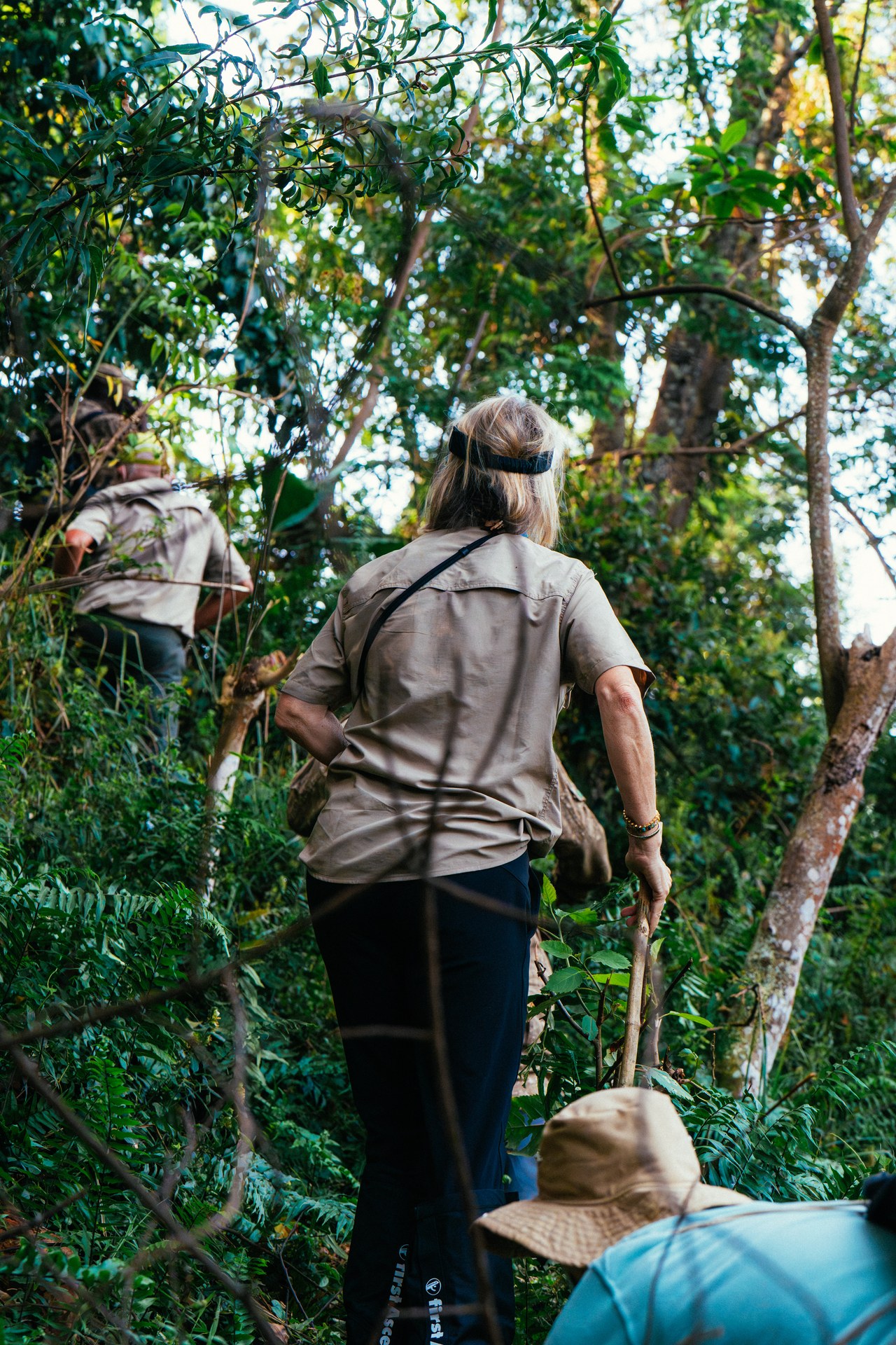
Through Bwindi forest on the trail of gorillas

Ranger in Bwindi forest on the way to the gorillas

Preparing for the adventure: gorilla trekking in Bwindi

Mountain Gorilla Peering Through Dense Forest Foliage
Mountain Gorilla