A Forest That Defies Simple Categories
After three hours of climbing through layered vegetation — first through stands of bamboo, then into a tangle of mid-canopy hardwoods, then up onto a ridge where giant fig trees spread their buttressed roots across the path — we finally reached the gorilla family. During my visit in June 2026, GPS coordinates confirmed we were at approximately -0.97°N, 29.63°E inside the forest. What struck me most before the gorillas appeared was the sheer variety of tree forms surrounding us: slender palms competing for gaps, massive emergents with bark thick as armour, and trees I could not name despite standing directly beneath them. That namelessness was not ignorance — it was a reminder of just how many species Bwindi holds.
Bwindi tree species diversity measurement is the scientific discipline that puts numbers to what visitors sense intuitively: this is no ordinary forest. Over 300 tree species have been recorded within the park's 321 square kilometres, ten of them endemic to the Albertine Rift and found nowhere else on Earth. Understanding how researchers arrive at these figures — and what the figures actually mean — is essential context for anyone who wants to appreciate what is genuinely at stake in this forest's conservation.
The Methods Behind the Numbers
Measuring tree diversity in a dense tropical forest is far more demanding than it sounds. Researchers cannot simply walk through and count: the canopy is too tall to see clearly from below, many species look similar in leaf and bark, and the forest itself resists straightforward navigation. The standard approach relies on permanently marked sampling plots, typically between 0.1 and 1 hectare in size, distributed across the different forest types and elevation zones within Bwindi.
Inside each plot, every woody stem above a defined diameter threshold — most commonly 10 centimetres measured at breast height, roughly 1.3 metres from the ground — is individually identified, tagged with a numbered metal plate, measured for diameter, and mapped with its GPS coordinates. Botanical identification often requires collecting leaf and flower specimens, which are then compared against herbarium reference collections. In some cases, specimens are sent to specialist institutions for confirmation. This process is painstaking: a single 1-hectare plot can contain over 200 individual trees representing 80 or more species, and identifying them all to species level may take weeks.
Transect surveys complement plot-based methods. A narrow corridor — perhaps two metres wide and several hundred metres long — is cut or flagged through the forest, and all trees within it are recorded. Transects allow researchers to cover a larger geographic area than fixed plots and are particularly useful for detecting rare species with patchy distributions. By combining data from multiple plots and transects across different sectors of Bwindi, scientists build a picture of overall species richness that no single survey could provide.
In recent years, aerial LiDAR (Light Detection and Ranging) surveys have added a new dimension to forest inventory work. Aircraft-mounted laser sensors produce three-dimensional maps of the forest canopy and sub-canopy layers, revealing structural variation across the entire park in ways that ground surveys cannot match. While LiDAR cannot identify individual tree species, it detects canopy gaps, height gradients, and density changes that help researchers prioritise where detailed ground surveys are most needed. Satellite multispectral imagery provides additional coverage, detecting large-scale patterns in forest composition by analysing how different vegetation types reflect light at different wavelengths.
What Altitude Does to Diversity
Bwindi rises from 1,160 metres in the Ishasha River valley to 2,607 metres on the high ridges near Ruhija. This elevational span creates a succession of distinct forest types, each with its own tree composition. Bwindi tree species diversity measurement must account for this vertical complexity, because a survey conducted only at mid-altitude would miss species that are restricted to either extreme.
In the lowest zones, the forest approaches the character of a lowland tropical rainforest. Trees grow tallest here — emergents exceeding 40 metres — with deeply developed buttress roots that anchor them in shallow, rain-saturated soils. Species from the Meliaceae and Sapotaceae families dominate, their large fruits supporting a rich community of primates and hornbills. Fig trees of the genus Ficus are ecological keystones at these elevations: they fruit asynchronously throughout the year, providing food continuity for animals during seasons when other species are not fruiting.
At mid-altitude, roughly between 1,500 and 2,000 metres, species richness reaches its peak. This zone captures both lowland species reaching their upper limits and montane species extending downward, maximising the overlap. Tree diversity at these elevations is among the highest of any forest in East Africa. Canopy height moderates to between 25 and 35 metres, and the understory becomes complex, with multiple distinct layers of sub-canopy trees, shrubs, and herbaceous plants.
Above 2,000 metres, the forest shifts into afromontane character. Trees become shorter, typically 15 to 25 metres, with smaller, thicker leaves adapted to cooler temperatures and increased UV radiation at altitude. Species such as Podocarpus— representatives of an ancient conifer lineage — appear, and tree trunks become heavily encrusted with mosses and epiphytic ferns. At the very highest ridges, bamboo (Arundinaria alpina) forms dense stands that function as a distinct ecosystem layer, providing food for mountain gorillas and habitat for specialist birds found nowhere else in Uganda.
Why Bwindi Holds So Many Species
The extraordinary figure of over 300 tree species in a single mountain park demands explanation. The answer lies partly in history and partly in geography. During the last ice age, when much of tropical Africa dried and cooled, many forests contracted or disappeared entirely. Bwindi, buffered by its altitude and the consistent moisture supply of the Albertine Rift valley system, survived largely intact. This made it a refugium — a place where species that had evolved over millions of years persisted while populations elsewhere were extinguished. The forest has had more than 25,000 years of continuous existence in roughly its current form, long enough for species richness to accumulate and stabilise.
Geography reinforces the history. Bwindi sits at the ecological junction between the forests of central Africa to the west and the drier woodlands of eastern Africa to the east. Species from both regional floras reach their range edges here. The Albertine Rift itself — the mountain chain running through western Uganda, Rwanda, Burundi, and the eastern Democratic Republic of Congo — is one of Africa's most significant zones of plant endemism. Ten of Bwindi's tree species are found only within this rift system, their distributions shaped by millions of years of geographic isolation and ecological specialisation.
The park's designation as a UNESCO World Heritage Site in 1994 explicitly recognised this biodiversity significance. Bwindi and the neighbouring Echuya Forest Reserve together represent a critical stronghold for endangered and restricted-range species across multiple taxonomic groups, not only among trees but also among birds, mammals, amphibians, and invertebrates. Research published in recent years confirms that both sites continue to function as refugia for species under pressure from habitat loss and climate shifts across the broader region.
Monitoring Change Over Time
Static species counts, however accurate, only capture a snapshot. The value of long-term forest monitoring lies in detecting change: which species are expanding, which are declining, and which may be disappearing. Permanent plots at Bwindi have been re-censused at intervals of five to ten years, revealing subtle but important shifts in tree community composition.
Researchers have noted changes in the relative abundance of some species that appear linked to shifts in rainfall patterns and temperature gradients. As the Albertine Rift region warms, montane tree species may find their optimal climate conditions gradually moving upslope, compressing the area of suitable habitat against the mountaintop. Species at the lower edge of their temperature tolerance may decline in the warmest parts of their range. These changes are subtle across decades but carry significant long-term implications for the forest's composition.
Disturbance from the forest boundary also affects tree diversity in the outer zones. Tourism infrastructure development, including access roads, lodge construction, and trail maintenance, has disturbed wildlife and vegetation corridors in some areas around Bwindi. Elephant and chimpanzee movement corridors connecting Bwindi to Kibale and other forest blocks have been affected by this kind of development, influencing which animal-dispersed tree species can successfully regenerate across the landscape. Researchers and park managers are increasingly attentive to these corridor dynamics as part of the broader conservation picture.
The Uganda Wildlife Authority maintains monitoring programs within the park, and organisations such as NatureUganda contribute complementary survey work that extends beyond the park boundary. These combined efforts are building the long-term dataset that will ultimately allow scientists to distinguish natural forest dynamics from human-driven change — a distinction that is essential for evidence-based forest management.
What the Numbers Mean in Practice
Standing under the canopy at Ruhija after a morning of gorilla tracking, it is easy to appreciate the forest empirically — as something vast and alive and ancient. But for conservation policy, the numbers produced by structured measurement matter enormously. Species richness figures inform the legal boundaries of the park, support applications for international funding, and provide the baseline against which future degradation or recovery can be assessed.
During my visits across multiple trips between October 2024 and June 2026, one of the consistent impressions was how the forest's character shifts within short distances. A descent from the ridge at Ruhija to the valley trail can pass through three distinct tree communities within 30 minutes of walking. Each community represents a different chapter in Bwindi's ecological history — and each contains species whose scientific value, whose role in the ecosystem, and whose survival prospects depend on the decisions made now about how this forest is managed.
The measurement of tree diversity is not an abstract academic exercise. It is the foundation of the case for conservation. Every species counted, every plot surveyed, and every re-census conducted strengthens the scientific argument that Bwindi Impenetrable Forest is irreplaceable — not only for the mountain gorillas that draw visitors from around the world, but for the full breadth of life that the trees support, shelter, and sustain.
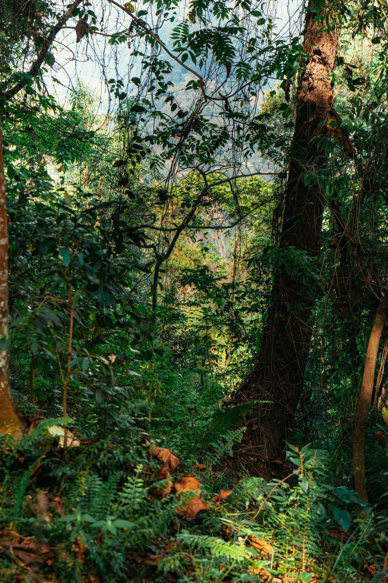
Dense jungle at the start of the gorilla trekking trail

Gorilla trekking in Bwindi: the path through the rainforest
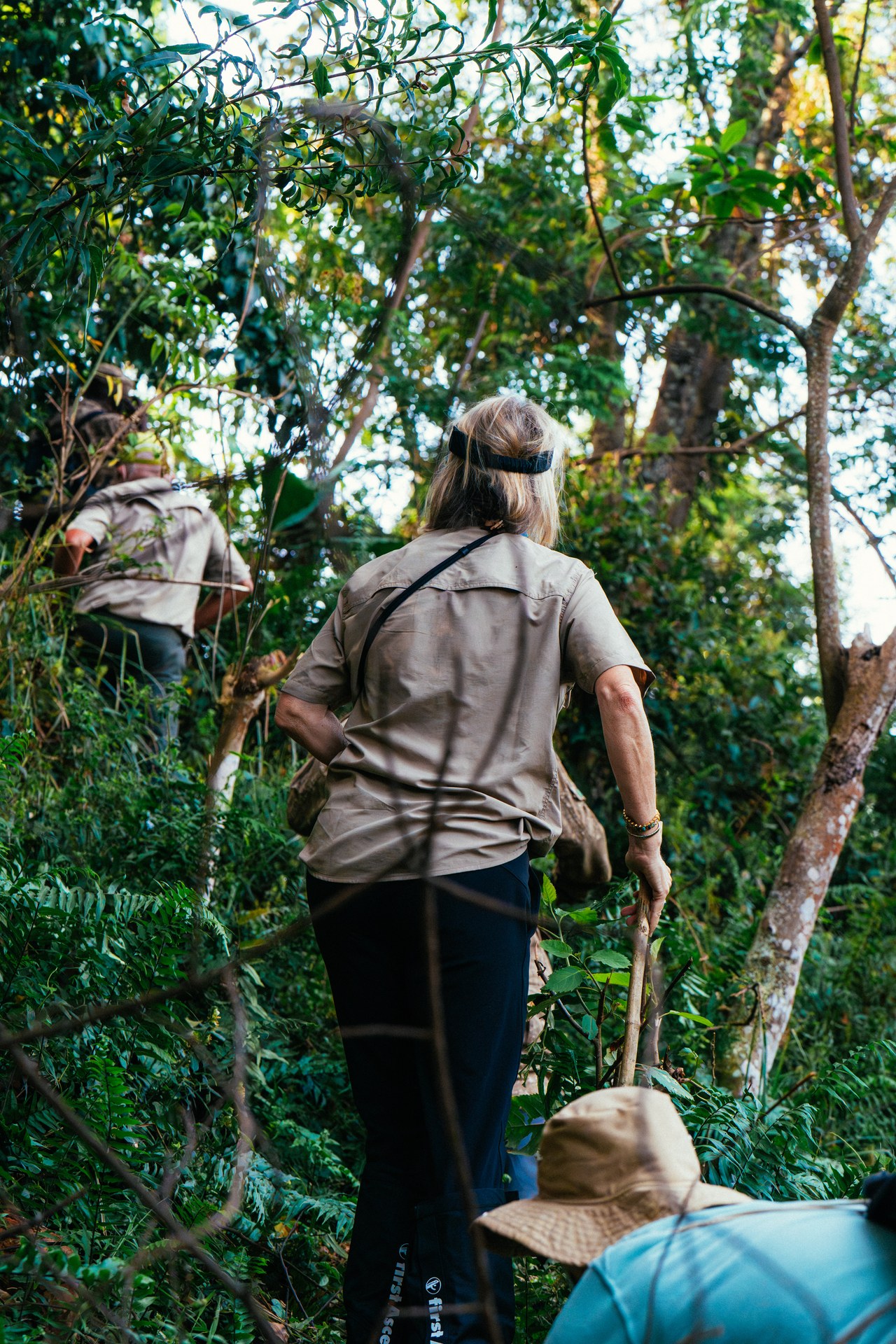
Through Bwindi forest on the trail of gorillas
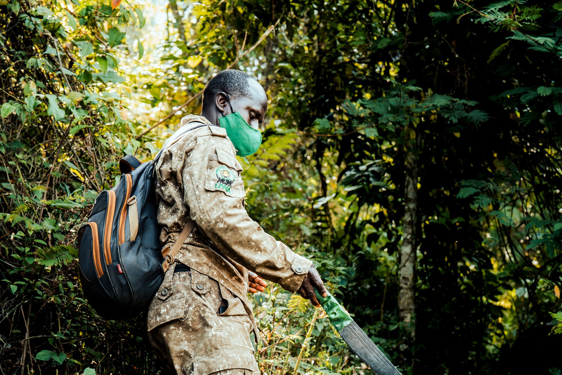
Ranger in Bwindi forest on the way to the gorillas

Preparing for the adventure: gorilla trekking in Bwindi
Mountain Gorilla Peering Through Dense Forest Foliage
Mountain Gorilla